alb3929000
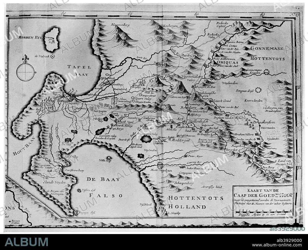
A map of the Cape of Good Hope in the time of the van der Stels, South Africa, 18th century (1931). Artist: Unknown
| Compartir |
|---|
 Pinterest Pinterest |
 Twitter Twitter |
 Facebook Facebook |
 Copiar enlace Copiar enlace |
 Email Email |
|
Añadir a otro lightbox |
|
Añadir a otro lightbox |


¿Ya tienes cuenta? Iniciar sesión
¿No tienes cuenta? Regístrate
Compra esta imagen

Título:
A map of the Cape of Good Hope in the time of the van der Stels, South Africa, 18th century (1931). Artist: Unknown
Descripción:
Ver traducción automática
A map of the Cape of Good Hope in the time of the van der Stels, South Africa, 18th century (1931).
Crédito:
Album / The Print Collector / Heritage Images
Autorizaciones:
Modelo: No - Propiedad: No
¿Preguntas relacionadas con los derechos?
¿Preguntas relacionadas con los derechos?
Tamaño imagen:
4799 x 3645 px | 50.0 MB
Tamaño impresión:
40.6 x 30.9 cm | 16.0 x 12.2 in (300 dpi)
Palabras clave:
AFRICA • AFRICANO • AGRICULTURA • ALCOHOL • ARTES • BEBER • BLANCO Y NEGRO • CABO DE BUENA ESPERANZA • CONTINENTE • ELABORACIÓN DEL VINO • IMPRESION • LIBRO • LITERATURA • MAPA • MONOCHROME • MONOCROMO • PAÍS • SIGLO XVIII • SIGLO • SUDÁFRICA
