alb3840178
Earthquake Zones Map
| Compartir |
|---|
 Pinterest Pinterest |
 Twitter Twitter |
 Facebook Facebook |
 Copiar enlace Copiar enlace |
 Email Email |
|
Añadir a otro lightbox |
|
Añadir a otro lightbox |


¿Ya tienes cuenta? Iniciar sesión
¿No tienes cuenta? Regístrate
Compra esta imagen

Título:
Earthquake Zones Map
Descripción:
Ver traducción automática
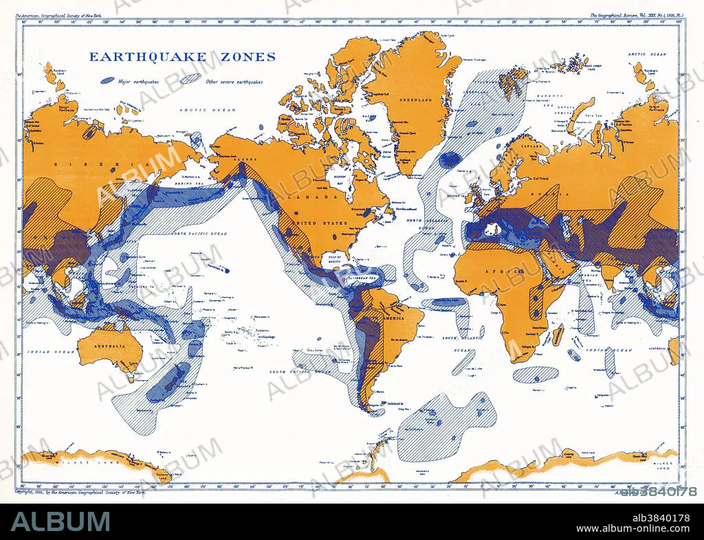
A map showing earthquake zones. This world seismicity map clearly shows the correlation of the Pacific Ring of Fire with earthquake epicentres, the Alpine-Himalayan Belt, and the coincidence of major portions of the mid-ocean ridge system with areas of seismicity.
Crédito:
Album / Science Source / National Oceanic and Atmospheric Administration
Autorizaciones:
Modelo: No - Propiedad: No
¿Preguntas relacionadas con los derechos?
¿Preguntas relacionadas con los derechos?
Tamaño imagen:
5140 x 3680 px | 54.1 MB
Tamaño impresión:
43.5 x 31.2 cm | 17.1 x 12.3 in (300 dpi)
Palabras clave:
ALPINOS • ANILLO • ARTE • CONTINENTE • ESQUEMA • FLOTA • FUEGO • GEOLOGIA • GRAFICO • ILUSTRACION • INFOGRAFÍA • MAPA • MAR • MARINA • MARINE • MUNDIAL • MUNDO • NADIE • OBRA DE ARTE • OCEANO • PLANETA TIERRA • SEA • SEISMO • SEISMOS • SISMO • SISMOS • TERREMOTO • TERREMOTOS • ZONAS
