alb3547570
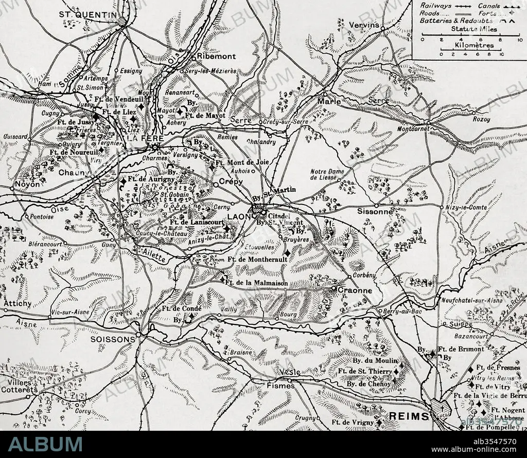
Map illustrating the region of the First Battle of the Aisne, fought along the Rivers Aisne, Oise and Somme, France during WWI
| Compartir |
|---|
 Pinterest Pinterest |
 Twitter Twitter |
 Facebook Facebook |
 Copiar enlace Copiar enlace |
 Email Email |
|
Añadir a otro lightbox |
|
Añadir a otro lightbox |


¿Ya tienes cuenta? Iniciar sesión
¿No tienes cuenta? Regístrate
Compra esta imagen

Título:
Map illustrating the region of the First Battle of the Aisne, fought along the Rivers Aisne, Oise and Somme, France during WWI
Descripción:
Ver traducción automática
Map illustrating the region of the First Battle of the Aisne, fought along the Rivers Aisne, Oise and Somme, France during WWI. From The War Illustrated Album Deluxe, published 1915.
Crédito:
Album / Universal Images Group / Universal History Archive
Autorizaciones:
Modelo: No - Propiedad: No
¿Preguntas relacionadas con los derechos?
¿Preguntas relacionadas con los derechos?
Tamaño imagen:
4835 x 3957 px | 54.7 MB
Tamaño impresión:
40.9 x 33.5 cm | 16.1 x 13.2 in (300 dpi)
Palabras clave:
AISNE • BATALLA • CONFLICTO BELICO • FRANCES • FRANCIA • GUERRA MUNDIAL I • GUERRA • LUCHA • MAPA • MUNDO • OCCIDENTAL • PRIMERA GUERRA MUNDIAL • PRIMERO • REGION • RIO • SOMME • UNO • WAR
