alb4087167
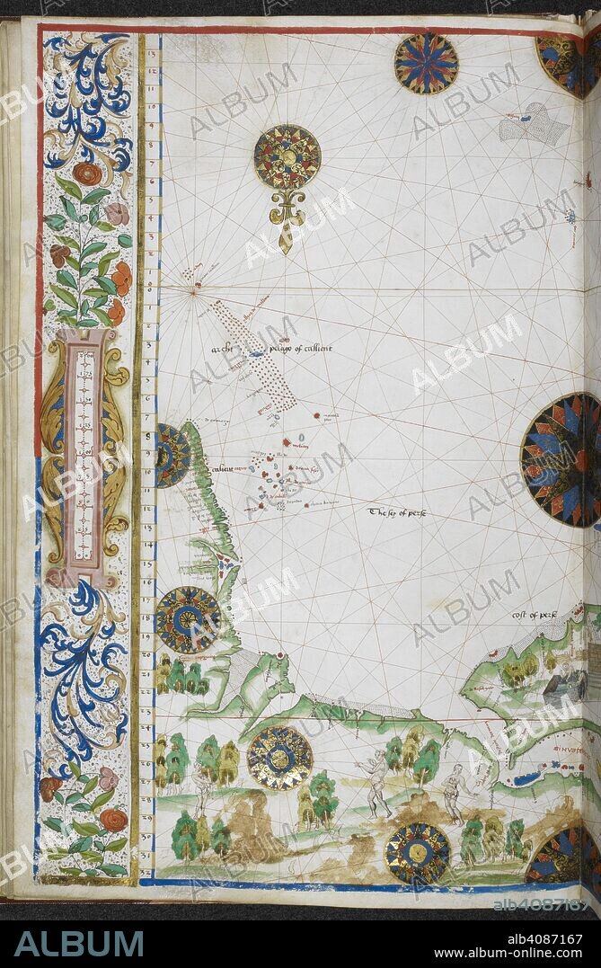
Chart of the coasts of Asia and Africa from Cape Comorin to Cape Delgado, including the Persian Gulf and the Red Sea. Jean Rotz, Boke of Idrography (The 'Rotz Atlas'). c 1535-1542. Source: Royal MS 20 E IX f.11v. Language: French & English.

|
Añadir a otro lightbox |
|
Añadir a otro lightbox |


¿Ya tienes cuenta? Iniciar sesión
¿No tienes cuenta? Regístrate
Compra esta imagen
|
?
Impresiones, tarjetas y regalos personales o referencias para artistas. Solo para un uso no comercial. No se permite la reventa.
|
$19.99 |
|
?
|
$19.99 |
|
?
|
$49.99 |
|
?
|
$69.99 |
|
?
|
$199.99 |
Añadir al carrito
Para otros usos,
Autor:
Descripción:
Ver traducción automática
Chart of the coasts of Asia and Africa from Cape Comorin to Cape Delgado, including the Persian Gulf and the Red Sea. Jean Rotz, Boke of Idrography (The 'Rotz Atlas'). c 1535-1542. Source: Royal MS 20 E IX f.11v. Language: French & English.
Crédito:
Album / British Library
Autorizaciones:
Modelo: No - Propiedad: No
¿Preguntas relacionadas con los derechos?
¿Preguntas relacionadas con los derechos?
Tamaño imagen:
4363 x 6682 px | 83.4 MB
Tamaño impresión:
36.9 x 56.6 cm | 14.5 x 22.3 in (300 dpi)
Palabras clave:
AFRICA • CARTOGRAFIA • CARTOGRAFICO • COLOR • COLORES • COSTA • DOCUMENTO • LITORAL • MANUSCRITO • MAPA • MAR ROJO • ORILLA DEL MAR • ROTZ, JEAN • SIGLO XVI
 Pinterest
 Twitter
 Facebook
 Copiar enlace
 Email
Email
