alb9871596
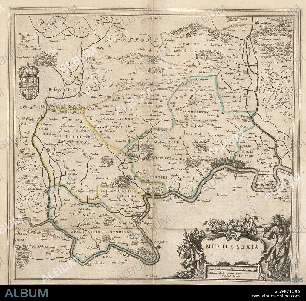
Map of the city of London and county of Middlesex, circa 1600. London shown as clutch of churches, surrounded by parishes Kensington, Chelsey, St. Gylles, Lambeth, Southwork, Hampton Court, on the River Thames, Hyde Park and Marybon Park. With title Middle-Sexia in cartouche and coat of arms. Handcoloured copperplate engraving by Johannes Blaeu from Geographiae Volumen Quintum quo Angliae, county atlas of England and Wales, Amsterdam, 1662.
| Compartir |
|---|
 Pinterest Pinterest |
 Twitter Twitter |
 Facebook Facebook |
 Copiar enlace Copiar enlace |
 Email Email |
|
Añadir a otro lightbox |
|
Añadir a otro lightbox |


¿Ya tienes cuenta? Iniciar sesión
¿No tienes cuenta? Regístrate
Compra esta imagen

Descripción:
Ver traducción automática
Map of the city of London and county of Middlesex, circa 1600. London shown as clutch of churches, surrounded by parishes Kensington, Chelsey, St. Gylles, Lambeth, Southwork, Hampton Court, on the River Thames, Hyde Park and Marybon Park. With title Middle-Sexia in cartouche and coat of arms. Handcoloured copperplate engraving by Johannes Blaeu from Geographiae Volumen Quintum quo Angliae, county atlas of England and Wales, Amsterdam, 1662.
Personas:
Crédito:
Album / Florilegius
Autorizaciones:
Modelo: No - Propiedad: No
¿Preguntas relacionadas con los derechos?
¿Preguntas relacionadas con los derechos?
Tamaño imagen:
5081 x 4740 px | 68.9 MB
Tamaño impresión:
43.0 x 40.1 cm | 16.9 x 15.8 in (300 dpi)
Palabras clave:
ALDEA • AMSTERDAM • CHURCH • CIUDAD • COLOREADO A MANO • CONDADO • ESCUDO DE ARMAS • GEOGRAFIA • GRABADO EN PLACA DE COBRE • GRAFICO • HAMPTON COURT • HISTORIA • HOLANDES • IGLESIA • KENSINGTON • LONDON • LONDRES • MAPA • PLAN • PUEBLO • RIO TAMESIS • TAMESIS • TOPOGRAFIA • WESTMINSTER
