alb9871568
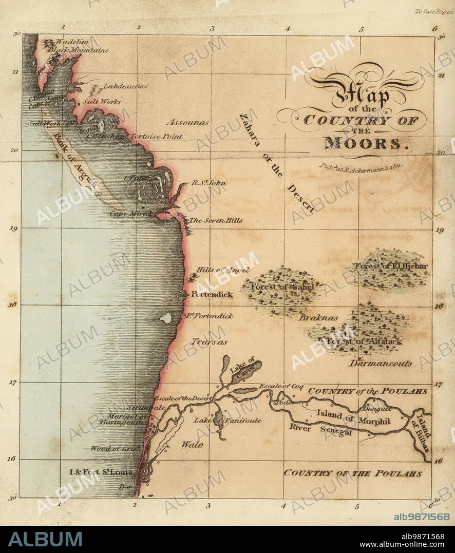
Map of Senegal and Mauritania, West Africa, 18th century. From St. Louis (Senegal) to the Bay of Arguin (Mauritania). Region of the Assounas, Poulahs, and other peoples. Map of the country of the Moors.After Rene Claude Geoffroy de Villeneuves LAfrique, Paris, 1814. Handcoloured stipple copperplate engraving from Frederic Shoberls The World in Miniature: Africa, A description of the manners and customs Moors of the Sahara and of the Negro Nations, R. Ackermann, England, 1821.
| Compartir |
|---|
 Pinterest Pinterest |
 Twitter Twitter |
 Facebook Facebook |
 Copiar enlace Copiar enlace |
 Email Email |
|
Añadir a otro lightbox |
|
Añadir a otro lightbox |


¿Ya tienes cuenta? Iniciar sesión
¿No tienes cuenta? Regístrate
Compra esta imagen

Descripción:
Ver traducción automática
Map of Senegal and Mauritania, West Africa, 18th century. From St. Louis (Senegal) to the Bay of Arguin (Mauritania). Region of the Assounas, Poulahs, and other peoples. Map of the country of the Moors.After Rene Claude Geoffroy de Villeneuves LAfrique, Paris, 1814. Handcoloured stipple copperplate engraving from Frederic Shoberls The World in Miniature: Africa, A description of the manners and customs Moors of the Sahara and of the Negro Nations, R. Ackermann, England, 1821.
Crédito:
Album / Florilegius
Autorizaciones:
Modelo: No - Propiedad: No
¿Preguntas relacionadas con los derechos?
¿Preguntas relacionadas con los derechos?
Tamaño imagen:
5501 x 6359 px | 100.1 MB
Tamaño impresión:
46.6 x 53.8 cm | 18.3 x 21.2 in (300 dpi)
Palabras clave:
