alb4094254
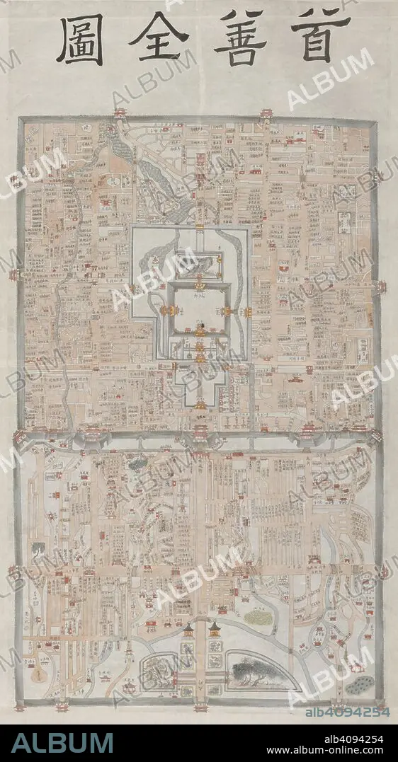
Peking. c.1800. This manuscript map of Peking appears to be based on a detailed survey carried out during the 18th century under the Ch'ing emperor Ch'ien-lung (r.1736-1796). The Imperial palace (the Forbidden City), is shown in the centre of the inner city. Originally published/produced in c.1800. . Source: Add. 22048,. Language: Chinese.
| Compartir |
|---|
 Pinterest Pinterest |
 Twitter Twitter |
 Facebook Facebook |
 Copiar enlace Copiar enlace |
 Email Email |
|
Añadir a otro lightbox |
|
Añadir a otro lightbox |


¿Ya tienes cuenta? Iniciar sesión
¿No tienes cuenta? Regístrate
Compra esta imagen

Descripción:
Ver traducción automática
Peking. c.1800. This manuscript map of Peking appears to be based on a detailed survey carried out during the 18th century under the Ch'ing emperor Ch'ien-lung (r.1736-1796). The Imperial palace (the Forbidden City), is shown in the centre of the inner city. Originally published/produced in c.1800. . Source: Add. 22048,. Language: Chinese.
Crédito:
Album / British Library
Autorizaciones:
Modelo: No - Propiedad: No
¿Preguntas relacionadas con los derechos?
¿Preguntas relacionadas con los derechos?
Tamaño imagen:
5376 x 9791 px | 150.6 MB
Tamaño impresión:
45.5 x 82.9 cm | 17.9 x 32.6 in (300 dpi)
Palabras clave:
ARTE • ARTES • ASENTAMIENTO • ASENTAMIENTOS • ASIA • AUTOPISTA • AUTOVÍA • CALLE • CAMINO • CARRETERA • CARTOGRAFIA • CHINA • CIUDAD • CRUCE • DISCIPLINA • HUMANIDADES • INFRAESTRUCTURA • MAPA • PEKIN
