alb5412071
Map of Black Death Pandemic Routes,14th Century
| Compartir |
|---|
 Pinterest Pinterest |
 Twitter Twitter |
 Facebook Facebook |
 Copiar enlace Copiar enlace |
 Email Email |
|
Añadir a otro lightbox |
|
Añadir a otro lightbox |


¿Ya tienes cuenta? Iniciar sesión
¿No tienes cuenta? Regístrate
Compra esta imagen

Título:
Map of Black Death Pandemic Routes,14th Century
Descripción:
Ver traducción automática
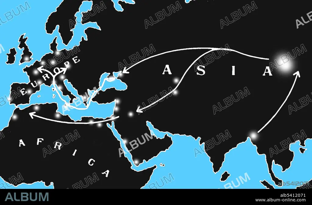
Map showing the spread of the Black Death in the 14th century from Asia to the Middle East, Western Europe, and North Africa. Areas of major outbreaks are indicated in white. The bubonic plague was one of the most devastating pandemics in human history, resulting in the deaths of an estimated 75 to 200 million people in Eurasia in the 14th century. The bacterium Yersinia pestis, which results in several forms of plague, is thought to have been the cause. It moved along the Silk Road (a network of trade routes) and by ship and is believed to have been carried and spread by rat fleas living on black rats.
Crédito:
Album / Science Source / Jessica Wilson
Autorizaciones:
Modelo: No - Propiedad: No
¿Preguntas relacionadas con los derechos?
¿Preguntas relacionadas con los derechos?
Tamaño imagen:
1846 x 1120 px | 5.9 MB
Tamaño impresión:
15.6 x 9.5 cm | 6.2 x 3.7 in (300 dpi)
Palabras clave:
ASIGNACIÓN • CARTOGRAFIA • CIENCIA • ENFERMEDAD • GEOGRAFIA • HISTORIA • MAPA • MEDIEVAL • NAVEGACION • ORIGEN • PANDEMIA • PESTE BUBONICA • PESTE, LA • RUTA COMERCIAL • RUTA DE LA SEDA • SIGLO XIV
