alb5366846
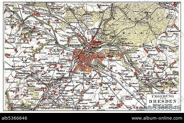
Map of Dresden and the surrounding area, Germany, Europe, end of the 19th Century, from Meyers Encyclopaedia, 1889, Europe.
| Compartir |
|---|
 Pinterest Pinterest |
 Twitter Twitter |
 Facebook Facebook |
 Copiar enlace Copiar enlace |
 Email Email |
|
Añadir a otro lightbox |
|
Añadir a otro lightbox |


¿Ya tienes cuenta? Iniciar sesión
¿No tienes cuenta? Regístrate
Compra esta imagen

Descripción:
Ver traducción automática
Map of Dresden and the surrounding area, Germany, Europe, end of the 19th Century, from Meyers Encyclopaedia, 1889, Europe
Crédito:
Album / ImageBroker / H.-D. Falkenstein
Autorizaciones:
Modelo: No - Propiedad: No
¿Preguntas relacionadas con los derechos?
¿Preguntas relacionadas con los derechos?
Tamaño imagen:
600 x 369 px | 648.6 KB
Tamaño impresión:
5.1 x 3.1 cm | 2.0 x 1.2 in (300 dpi)
Palabras clave:
ALEMANIA • CARTAS • CUADRO • CUADROS • EDAD • ENCICLOPEDIA • EUROPA • FIGURA • HISTORIA • HISTORICO • ILUSTRACION • LABOR • LIBRO DE REFERENCIA • LIBRO • LIBROS • MAPA DE CARRETERAS • MAPA • PINTURA • PINTURAS • REPRESENTACIONES • REPUBLICA FEDERAL ALEMANA • SAJON • SAJONIA • SIGLO XIX • TARJETA • TARJETAS • TRABAJANDO • TRABAJO
