alb3801529
Carolingian Empire, 9th Century
| Partager |
|---|
 Pinterest Pinterest |
 Twitter Twitter |
 Facebook Facebook |
 Copier le lien Copier le lien |
 Email Email |
|
Ajouter à une autre Lightbox |
|
Ajouter à une autre Lightbox |


Avez-vous déjà un compte? S'identifier
Vous n'avez pas de compte ? S'inscrire
Acheter cette image

Titre:
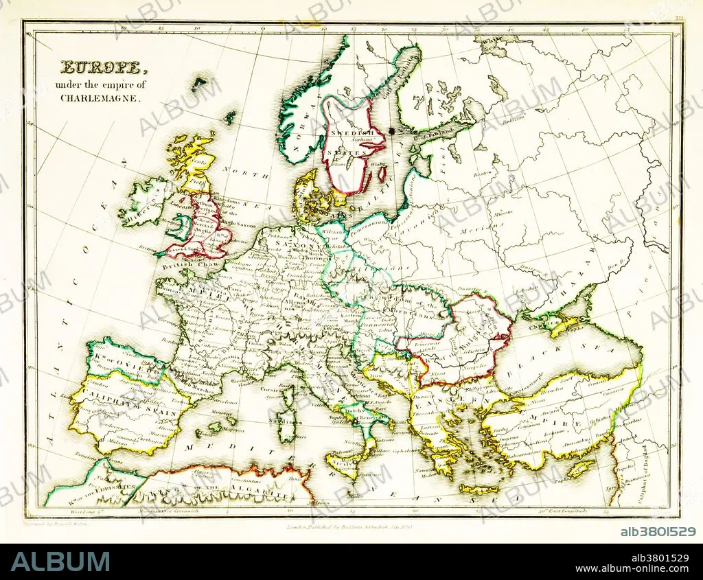
Carolingian Empire, 9th Century
Légende:
Voir la traduction automatique
A map of Europe, showing territorial borders existing in the 9th century, under the reign of Charlemagne. Charlemagne (748-814) was the King of the Franks from 768, the King of Italy from 774, and from 800 the first emperor in western Europe since the collapse of the Western Roman Empire three centuries earlier. The expanded Frankish state he founded is called the Carolingian Empire. Map published in 1831.
Crédit:
Album / Science Source / British Library
Autorisations:
Modèle: Non - Propriété: Non
Questions sur les droits?
Questions sur les droits?
Taille de l'image:
3543 x 2742 px | 27.8 MB
Taille d'impression:
30.0 x 23.2 cm | 11.8 x 9.1 in (300 dpi)
Mots clés:
9E SIECLE • 9EME S • CARTE • CARTOGRAPHIE • CHANGER • EUROPÉEN • FRANC (PEUPLE) • ILLUSTRATION • SCIENCE: CARTOGRAPHIE
