alb4062591
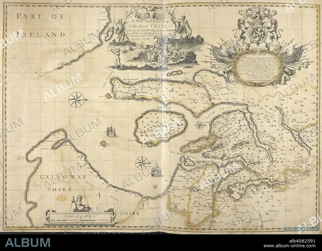
A New and Exact Map Of the River Clyde. A New and Exact Map Of the River CLYDE / Done by the late Mr John Adair Hidrographer and Fellow of the Royal Society and now Publish'd for the Good of the Publick by Geo: Scott. Glasgow, 1731. 1 map : copperplate engraving with hand colour ; 48 x 68 cm; Scale approximately 1:253,440. Source: Maps K.Top 48/76.
| Partager |
|---|
 Pinterest Pinterest |
 Twitter Twitter |
 Facebook Facebook |
 Copier le lien Copier le lien |
 Email Email |
|
Ajouter à une autre Lightbox |
|
Ajouter à une autre Lightbox |


Avez-vous déjà un compte? S'identifier
Vous n'avez pas de compte ? S'inscrire
Acheter cette image

Auteur:
Légende:
Voir la traduction automatique
A New and Exact Map Of the River Clyde. A New and Exact Map Of the River CLYDE / Done by the late Mr John Adair Hidrographer and Fellow of the Royal Society and now Publish'd for the Good of the Publick by Geo: Scott. Glasgow, 1731. 1 map : copperplate engraving with hand colour ; 48 x 68 cm; Scale approximately 1:253,440. Source: Maps K.Top 48/76.
Crédit:
Album / British Library
Autorisations:
Modèle: Non - Propriété: Non
Questions sur les droits?
Questions sur les droits?
Taille de l'image:
6253 x 4553 px | 81.5 MB
Taille d'impression:
52.9 x 38.5 cm | 20.8 x 15.2 in (300 dpi)
Mots clés:
ADAIR, JOHN • ANGLETARRE • ANGLETERE • ANGLETERRE • CARTE (GEOGRAPHIE) • CARTE GEOGRAPHIQUE • CARTE • CARTOGRAPHIE • DESSIN PLANS • ECOSSE • EUROPE • GRANDE BERTAGNE • GRANDE BRETAGNE • GRANDE-BRETAGNE • INGLATERRA • IRELANDE • IRLANDE • PLAN (CARTOGRAPHIE) • PLANS • ROYAUME UNI • ROYAUME-UNI • SCIENCE: CARTOGRAPHIE
