alb5407683
Tabula Peutingeriana, Roman Empire Road Map
| Partager |
|---|
 Pinterest Pinterest |
 Twitter Twitter |
 Facebook Facebook |
 Copier le lien Copier le lien |
 Email Email |
|
Ajouter à une autre Lightbox |
|
Ajouter à une autre Lightbox |


Avez-vous déjà un compte? S'identifier
Vous n'avez pas de compte ? S'inscrire
Acheter cette image

Titre:
Tabula Peutingeriana, Roman Empire Road Map
Légende:
Voir la traduction automatique
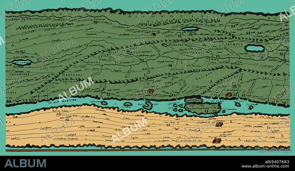
Detail of the Tabula Peutingeriana, an illustrated itinerarium (road map) showing the cursus publicus, the road network in the Roman Empire. The original map upon which it is based probably dates to the 4th or 5th century and was itself based on a map prepared by Agrippa during the reign of the emperor Augustus (27 BC - 14 AD) prepared under the direction of Marcus Vipsanius Agrippa, a friend of Augustus. After Agrippa's death, the map was engraved on marble and placed in the Porticus Vipsaniae, not far from the Ara Pacis.
Crédit:
Album / Science Source
Autorisations:
Modèle: Non - Propriété: Non
Questions sur les droits?
Questions sur les droits?
Taille de l'image:
5175 x 2737 px | 40.5 MB
Taille d'impression:
43.8 x 23.2 cm | 17.2 x 9.1 in (300 dpi)
Mots clés:
