alb3808235
Map of Livingstone's Route Across Africa, 1857
| Partager |
|---|
 Pinterest Pinterest |
 Twitter Twitter |
 Facebook Facebook |
 Copier le lien Copier le lien |
 Email Email |
|
Ajouter à une autre Lightbox |
|
Ajouter à une autre Lightbox |


Avez-vous déjà un compte? S'identifier
Vous n'avez pas de compte ? S'inscrire
Acheter cette image

Titre:
Map of Livingstone's Route Across Africa, 1857
Légende:
Voir la traduction automatique
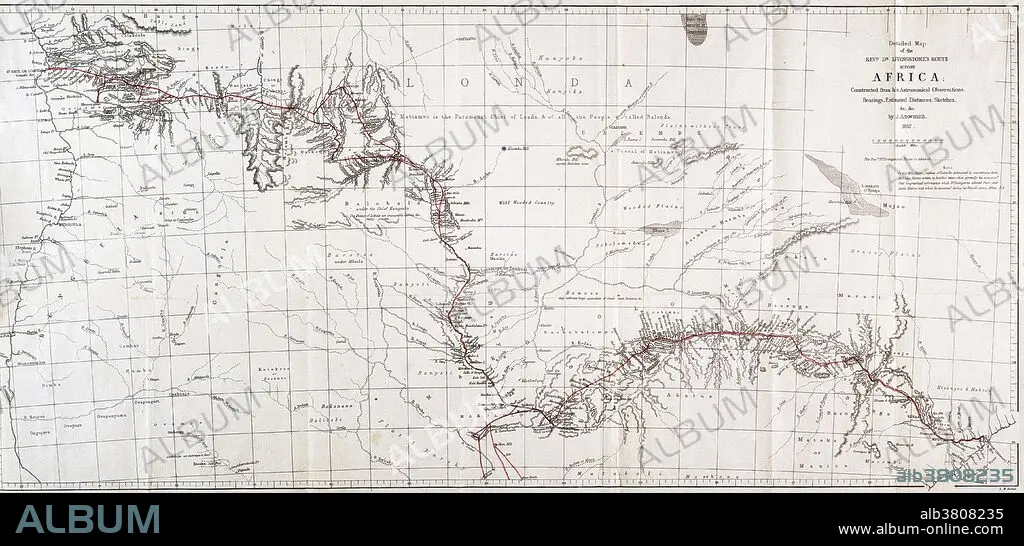
Map showing the route of David Livingstone across central Africa via the Zambesi River to the east coast, 1857. David Livingstone (1813-1873) was a Scottish explorer and medical missionary in Africa. He organized expeditions into the interior of Africa from Botswana, discovered and named Victoria Falls, and located the mouth of the Zambesi River. He mapped much of interior Africa, wrote accounts of the inhabitants, and campaigned against slavery. Along with Henry Morton Stanley, he became a celebrity in the eyes of a Victorian public captivated by their explorations.
Crédit:
Album / Science Source / Wellcome Images
Autorisations:
Modèle: Non - Propriété: Non
Questions sur les droits?
Questions sur les droits?
Taille de l'image:
5603 x 2700 px | 43.3 MB
Taille d'impression:
47.4 x 22.9 cm | 18.7 x 9.0 in (300 dpi)
Mots clés:
