alb5411336
Roanoke Colony Map,1585
| Partager |
|---|
 Pinterest Pinterest |
 Twitter Twitter |
 Facebook Facebook |
 Copier le lien Copier le lien |
 Email Email |
|
Ajouter à une autre Lightbox |
|
Ajouter à une autre Lightbox |


Avez-vous déjà un compte? S'identifier
Vous n'avez pas de compte ? S'inscrire
Acheter cette image

Titre:
Roanoke Colony Map,1585
Légende:
Voir la traduction automatique
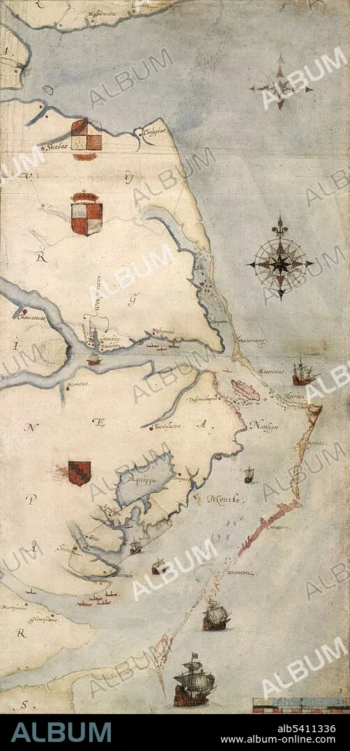
John White's map of the Roanoke Colony area, c. 1585. The first colony on Roanoke Island was established by governor Ralph Lane in 1585. Following the failure of the 1585 settlement, a second colony led by John White landed on the same island in 1587, and became known as the Lost Colony due to the unexplained disappearance of its population.
Crédit:
Album / Science Source
Autorisations:
Modèle: Non - Propriété: Non
Questions sur les droits?
Questions sur les droits?
Taille de l'image:
1800 x 3675 px | 18.9 MB
Taille d'impression:
15.2 x 31.1 cm | 6.0 x 12.2 in (300 dpi)
Mots clés:
16E SIECLE • 16EME S • CAMPEMENT • COLON • COLONIALISME • COLONIE • ILLUSTRATION • SEIZIÈME SIÈCLE • XVIE SIECLE
