alb1656065
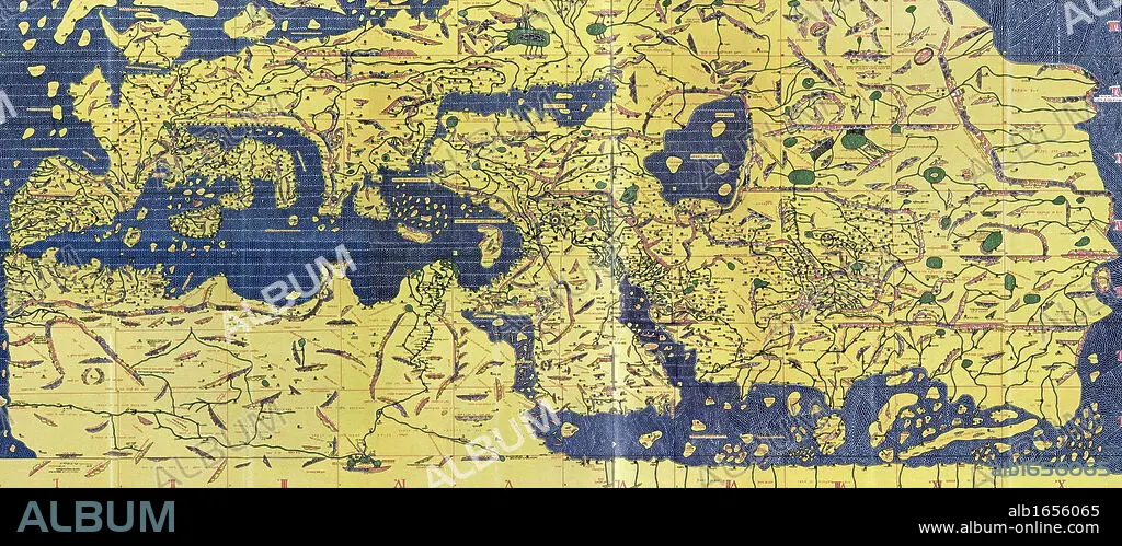
The Tabula Rogeriana, drawn by al-Idrisi for Roger II of Sicily in 1154, an important ancient world map.
| Partager |
|---|
 Pinterest Pinterest |
 Twitter Twitter |
 Facebook Facebook |
 Copier le lien Copier le lien |
 Email Email |
|
Ajouter à une autre Lightbox |
|
Ajouter à une autre Lightbox |


Avez-vous déjà un compte? S'identifier
Vous n'avez pas de compte ? S'inscrire
Acheter cette image

Légende:
Voir la traduction automatique
The Tabula Rogeriana, drawn by al-Idrisi for Roger II of Sicily in 1154, an important ancient world map.
Crédit:
Album / Universal Images Group / Universal History Archive
Autorisations:
Modèle: Non - Propriété: Non
Questions sur les droits?
Questions sur les droits?
Taille de l'image:
6600 x 2873 px | 54.3 MB
Taille d'impression:
55.9 x 24.3 cm | 22.0 x 9.6 in (300 dpi)
Mots clés:
