alb3120066
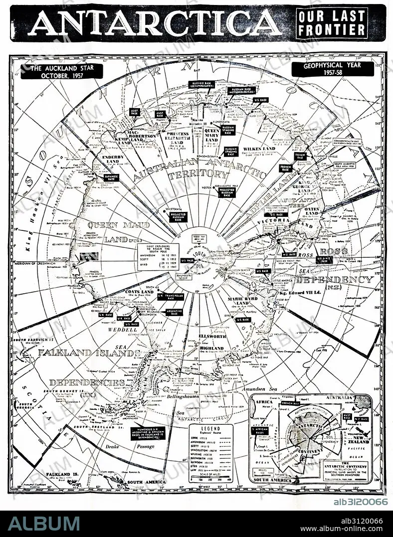
Antarctica map showing the various national zones.
| Partager |
|---|
 Pinterest Pinterest |
 Twitter Twitter |
 Facebook Facebook |
 Copier le lien Copier le lien |
 Email Email |
|
Ajouter à une autre Lightbox |
|
Ajouter à une autre Lightbox |


Avez-vous déjà un compte? S'identifier
Vous n'avez pas de compte ? S'inscrire
Acheter cette image

Titre:
Antarctica map showing the various national zones.
Légende:
Voir la traduction automatique
Antarctica map showing the various national zones or bases for countries including the UK; France; USA; Russia, 1958.
Crédit:
Album / Universal Images Group / Universal History Archive
Autorisations:
Modèle: Non - Propriété: Non
Questions sur les droits?
Questions sur les droits?
Taille de l'image:
4016 x 5222 px | 60.0 MB
Taille d'impression:
34.0 x 44.2 cm | 13.4 x 17.4 in (300 dpi)
Mots clés:
AMERICAIN (ETATS-UNIS) • AMERICAIN (USA) • CARTE (GEOGRAPHIE) • CARTE GEOGRAPHIQUE • CARTE • CARTOGRAPHIE • DESSIN PLANS • ÉTAS UNIS • ÉTAS-UNIS • ETATS UNIS • ETATS-UNIS • FRANCE • IMPERIALISME • NATIONAL • PLAN (CARTOGRAPHIE) • PLANS • RIVALITE • RUSSIE • SCIENCE: CARTOGRAPHIE • U. S. A. • XXE SIECLE • ŽTATS-UNIS
