alb3803932
Gerardus Mercator
| Partager |
|---|
 Pinterest Pinterest |
 Twitter Twitter |
 Facebook Facebook |
 Copier le lien Copier le lien |
 Email Email |
|
Ajouter à une autre Lightbox |
|
Ajouter à une autre Lightbox |


Avez-vous déjà un compte? S'identifier
Vous n'avez pas de compte ? S'inscrire
Acheter cette image

Titre:
Gerardus Mercator
Légende:
Voir la traduction automatique
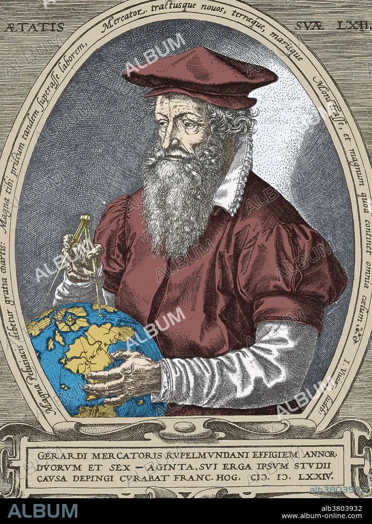
Flemish geographer Gerardus Mercator (1512-1594). Mercator's most enduring contribution was his Mercator Projection, or Mercator Chart. The Mercator Projection became the standard map for nautical use, because it depicted accurate shapes of land mass and also accurate directions used for determining bearing. It did so at the expense of scale, which was distorted. His work was continued by his son, Rumold Mercator. Colored Version of BD8016.
Crédit:
Album / SCIENCE SOURCE
Autorisations:
Modèle: Non - Propriété: Non
Questions sur les droits?
Questions sur les droits?
Taille de l'image:
3445 x 4614 px | 45.5 MB
Taille d'impression:
29.2 x 39.1 cm | 11.5 x 15.4 in (300 dpi)
Mots clés:
CARTE • CARTOGRAPHE • CARTOGRAPHIE • CÉLÈBRE • CELEBRITE • GEOGRAPHIE • HOMME • ILLUSTRATION • PERSONNE • PORTAIT • PORTRAIT • POTRAIT • SCIENCE: CARTOGRAPHIE
