alb3860694
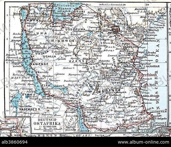
Map of the former German colony of East Africa, Meyers Konversations-Lexikon encyclopedia 1897.
| Partager |
|---|
 Pinterest Pinterest |
 Twitter Twitter |
 Facebook Facebook |
 Copier le lien Copier le lien |
 Email Email |
|
Ajouter à une autre Lightbox |
|
Ajouter à une autre Lightbox |


Avez-vous déjà un compte? S'identifier
Vous n'avez pas de compte ? S'inscrire
Acheter cette image.
Sélectionnez l'usage:

Légende:
Voir la traduction automatique
Map of the former German colony of East Africa, Meyers Konversations-Lexikon encyclopedia 1897
Crédit:
Album / ImageBroker / Michael Nitzschke
Autorisations:
Taille de l'image:
4676 x 3743 px | 50.1 MB
Taille d'impression:
39.6 x 31.7 cm | 15.6 x 12.5 in (300 dpi)
Mots clés:
AFRIQUE • ALLEMAND • ALLEMANDE • ATELIER • CARACTÈRE • CARTE • CARTES • CARTON • GEOGRAPHIE • ILLUSTRATION • OBJET • OBJETS • PORTRAIT EN PIED • PRISE DE VUES EN STUDIO
