alb4062015
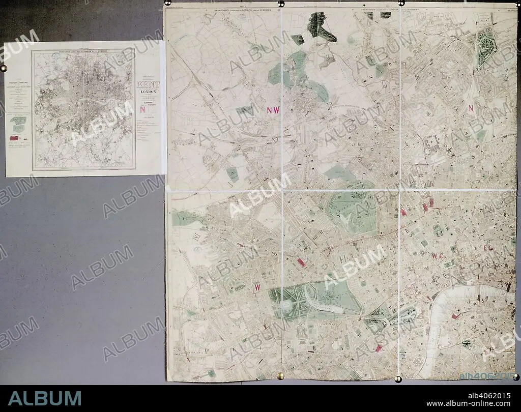
Map of London. Stanford's Library Map of London and its suburbs. London : E. Stanford, 1886. Stanford's Library Map of London and its suburbs. Image taken from Stanford's Library Map of London and its suburbs. Scale, 6 inches to 1 Eng. statute mile, or 1 : 10,560. Originally published/produced in London : E. Stanford, 1886. . Source: Maps.3480.(260), sheet 1. Language: English.
| Partager |
|---|
 Pinterest Pinterest |
 Twitter Twitter |
 Facebook Facebook |
 Copier le lien Copier le lien |
 Email Email |
|
Ajouter à une autre Lightbox |
|
Ajouter à une autre Lightbox |


Avez-vous déjà un compte? S'identifier
Vous n'avez pas de compte ? S'inscrire
Acheter cette image

Légende:
Voir la traduction automatique
Map of London. Stanford's Library Map of London and its suburbs. London : E. Stanford, 1886. Stanford's Library Map of London and its suburbs. Image taken from Stanford's Library Map of London and its suburbs. Scale, 6 inches to 1 Eng. statute mile, or 1 : 10,560. Originally published/produced in London : E. Stanford, 1886. . Source: Maps.3480.(260), sheet 1. Language: English.
Crédit:
Album / British Library
Autorisations:
Modèle: Non - Propriété: Non
Questions sur les droits?
Questions sur les droits?
Taille de l'image:
5808 x 4293 px | 71.3 MB
Taille d'impression:
49.2 x 36.3 cm | 19.4 x 14.3 in (300 dpi)
Mots clés:
ANGLETARRE • ANGLETERE • ANGLETERRE • ARCHITECTURE: BIBLIOTHEQUE • BIBLIOTHEQUE • CARTE (GEOGRAPHIE) • CARTE GEOGRAPHIQUE • CARTE • CARTOGRAPHIE • CELLULE DE PRISON • DESSIN PLANS • ECRITURE BIBLIOTHEQUE • EUROPE • GRANDE BERTAGNE • GRANDE BRETAGNE • GRANDE-BRETAGNE • INGLATERRA • JUSTICE PRISON • LONDRES • LONDRES, VUE SUR • LONDRES, VUE • PLAN (CARTOGRAPHIE) • PLANS • PRISON • ROYAUME UNI • ROYAUME-UNI • SCIENCE: CARTOGRAPHIE • SERPENTIN • VUE LONDRES
