alb4539461
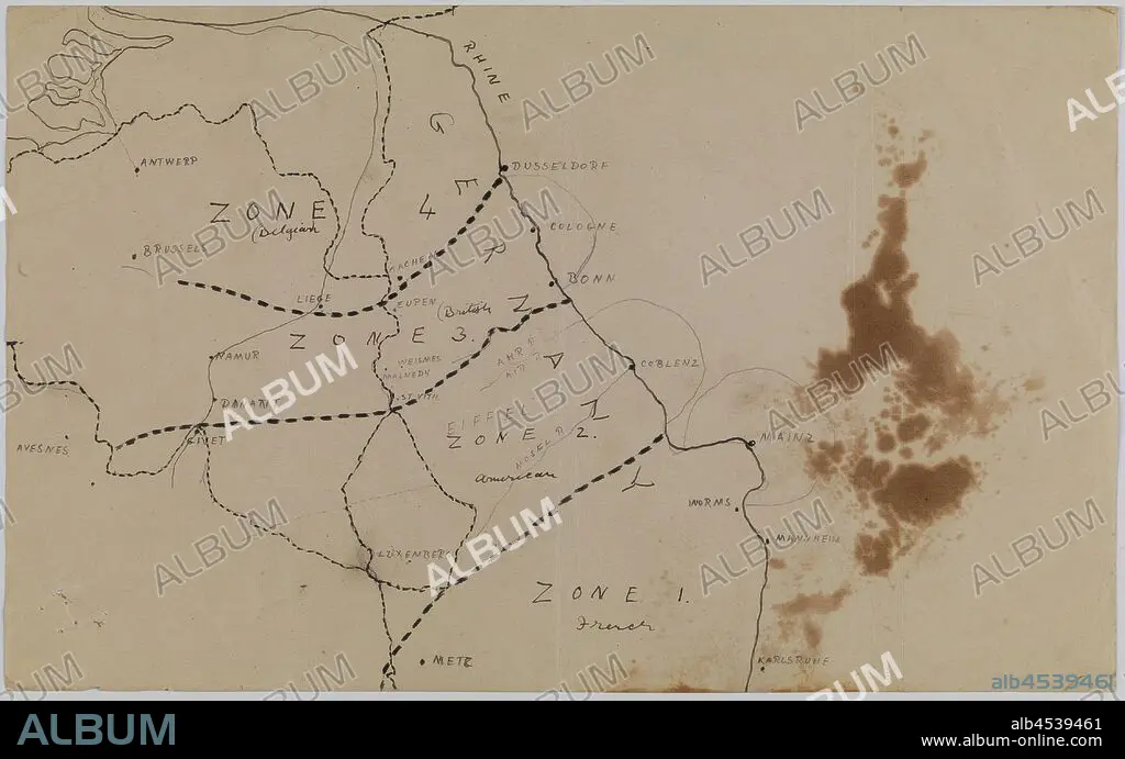
Map - Germany, Occupation Zones 1 to 4, World War I, circa 1919, Alternative Name(s): Rhineland Occupation Map Map of the occupied Rhineland in Germany after World War I, showing Zones 1 to 4 occupied by France, Belgium and American forces. According to Joachim Schröder and Alexander Watson, the ceasefire agreement from 11 November 1918 'merely provided for the Allied occupation of the left bank of the Rhine and three bridgeheads near Cologne, Mainz,.
| Partager |
|---|
 Pinterest Pinterest |
 Twitter Twitter |
 Facebook Facebook |
 Copier le lien Copier le lien |
 Email Email |
|
Ajouter à une autre Lightbox |
|
Ajouter à une autre Lightbox |


Avez-vous déjà un compte? S'identifier
Vous n'avez pas de compte ? S'inscrire
Acheter cette image

Légende:
Voir la traduction automatique
Map - Germany, Occupation Zones 1 to 4, World War I, circa 1919, Alternative Name(s): Rhineland Occupation Map Map of the occupied Rhineland in Germany after World War I, showing Zones 1 to 4 occupied by France, Belgium and American forces. According to Joachim Schröder and Alexander Watson, the ceasefire agreement from 11 November 1918 'merely provided for the Allied occupation of the left bank of the Rhine and three bridgeheads near Cologne, Mainz,
Crédit:
Album / quintlox
Autorisations:
Modèle: Non - Propriété: Non
Questions sur les droits?
Questions sur les droits?
Taille de l'image:
4500 x 2802 px | 36.1 MB
Taille d'impression:
38.1 x 23.7 cm | 15.0 x 9.3 in (300 dpi)
