alb3195216
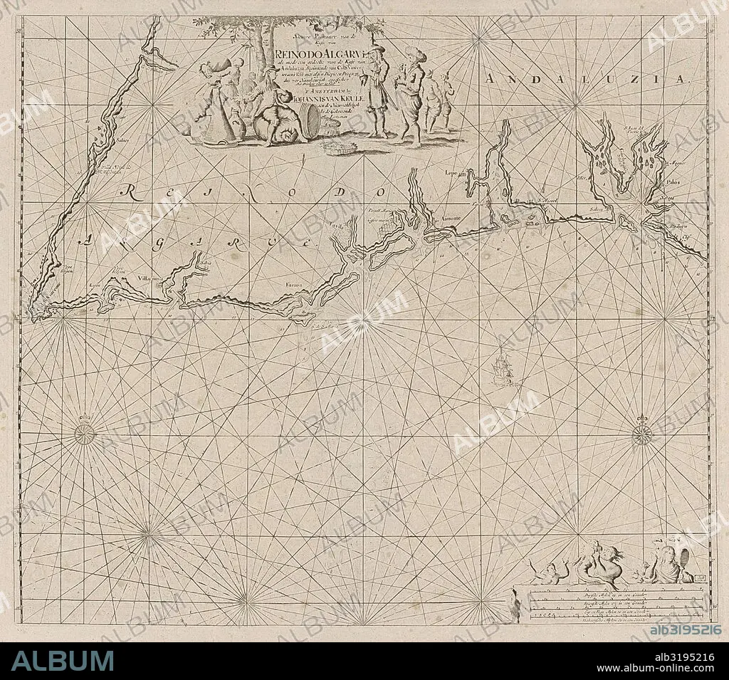
Sea map of part of the south coast of Portugal and Spain with the Algarve and Andalucia, Jan Luyken, Anonymous, Johannes van Keulen (I), 1681 - 1803.
| Partager |
|---|
 Pinterest Pinterest |
 Twitter Twitter |
 Facebook Facebook |
 Copier le lien Copier le lien |
 Email Email |
|
Ajouter à une autre Lightbox |
|
Ajouter à une autre Lightbox |


Avez-vous déjà un compte? S'identifier
Vous n'avez pas de compte ? S'inscrire
Acheter cette image

Légende:
Voir la traduction automatique
Sea map of part of the south coast of Portugal and Spain with the Algarve and Andalucia, Jan Luyken, Anonymous, Johannes van Keulen (I), 1681 - 1803
Crédit:
Album / quintlox
Autorisations:
Modèle: Non - Propriété: Non
Questions sur les droits?
Questions sur les droits?
Taille de l'image:
4191 x 3692 px | 44.3 MB
Taille d'impression:
35.5 x 31.3 cm | 14.0 x 12.3 in (300 dpi)
Mots clés:
ALLEMAND • ALLEMANDE • ANDALOUSIE • ANGALIS • ANGLAIS • ANGLAISE • BOUSSOLE • CARTE (GEOGRAPHIE) • CARTE GEOGRAPHIQUE • CARTE • CARTOGRAPHIE • DESSIN PLANS • ESPAGNE • ESPAGNOL • FRANÁAIS • FRANÁAISE • FRANÇAIS • GEOGRAPHIE • MARCHANDER • MARIN • MARINE MARINS • MARINIER • MARINS • MATELOT • MER • MIROIR • MIROIRS • MONDE • NORD • OCEAN • ONDIN • PAYSAGE MARITIME • PLAN (CARTOGRAPHIE) • PLANS • PORTUGAL • SCIENCE: CARTOGRAPHIE • SUD
