alb3793056
Topographical Map of Coordinates 0 N, 90 E
| Partager |
|---|
 Pinterest Pinterest |
 Twitter Twitter |
 Facebook Facebook |
 Copier le lien Copier le lien |
 Email Email |
|
Ajouter à une autre Lightbox |
|
Ajouter à une autre Lightbox |


Avez-vous déjà un compte? S'identifier
Vous n'avez pas de compte ? S'inscrire
Acheter cette image.
Sélectionnez l'usage:

Titre: Topographical Map of Coordinates 0 N, 90 E
Légende: Voir la traduction automatique
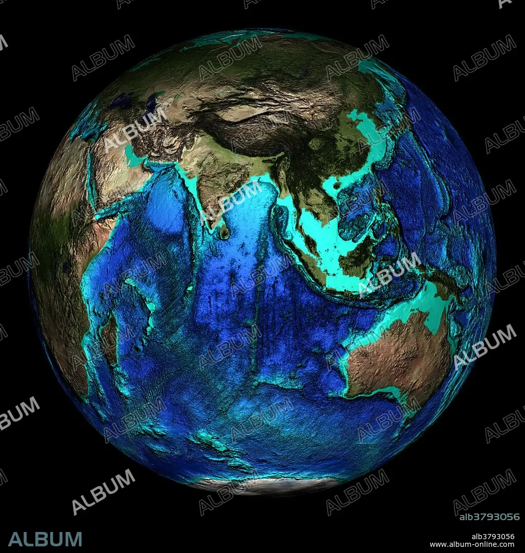
Topographical map of the Earth, centered on 0 degrees North, 90 degrees East. The major land masses shown here are India, Southeast Asia and Australia surrounded by the Indian Ocean. The seas and oceans are color-coded by depth and land colors are based on MODIS true-color data from the Terra satellite in 2004 where darker regions represent highlands. Turquoise regions represent the continental shelf and descend to around 150 meters before dropping off abruptly at the shelf break. The descent of the continental slope to the ocean floor is shown as increasingly dark shades of blue.
Topographical map of the Earth, centered on 0 degrees North, 90 degrees East. The major land masses shown here are India, Southeast Asia and Australia surrounded by the Indian Ocean. The seas and oceans are color-coded by depth and land colors are based on MODIS true-color data from the Terra satellite in 2004 where darker regions represent highlands. Turquoise regions represent the continental shelf and descend to around 150 meters before dropping off abruptly at the shelf break. The descent of the continental slope to the ocean floor is shown as increasingly dark shades of blue.
Crédit: Album / NOAA/Science Source
Autorisations: ? Autorisation de modèle: Non - ? Autorisation de propriété: Non
Questions sur les droits?
Questions sur les droits?
Taille de l'image: 2400 × 2400 px | 16.5 MB
Taille d'impression: 20.3 × 20.3 cm | 944.9 × 944.9 in (300 dpi)
Mots clés: AFRIQUE • ASIE • ASIE, CONTINENT • ASTRONOMIE: PLANETES • AUSTRALIE • CARTE • CARTOGRAPHIE • CONTINENT ASIE • GEOGRAPHIE • GLOBE • MER • OCEAN • OCEANOGRAPHIE • PAYSAGE MARITIME • PLANETE • PLANÈTES • SCIENCE: CARTOGRAPHIE • TERRA • TOPOGRAPHIE
