alb3546473
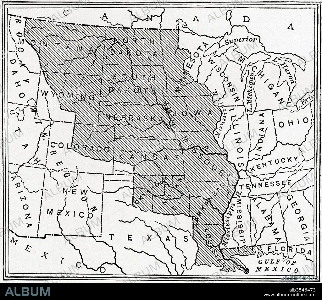
Map showing The Louisiana Purchase
| Partager |
|---|
 Pinterest Pinterest |
 Twitter Twitter |
 Facebook Facebook |
 Copier le lien Copier le lien |
 Email Email |
|
Ajouter à une autre Lightbox |
|
Ajouter à une autre Lightbox |


Avez-vous déjà un compte? S'identifier
Vous n'avez pas de compte ? S'inscrire
Acheter cette image

Titre:
Map showing The Louisiana Purchase
Légende:
Voir la traduction automatique
Map showing The Louisiana Purchase. The acquisition of the Louisiana territory (828,000 square miles) by the United States from France in 1803. From The History of Our Country, published 1900
Crédit:
Album / Universal Images Group / Universal History Archive
Autorisations:
Modèle: Non - Propriété: Non
Questions sur les droits?
Questions sur les droits?
Taille de l'image:
4572 x 4026 px | 52.7 MB
Taille d'impression:
38.7 x 34.1 cm | 15.2 x 13.4 in (300 dpi)
Mots clés:
AMÉRCAIN • AMERICAIN (ETATS-UNIS) • AMERICAIN (USA) • AMÉRICAIN • AMÉRICAINE • AMÉRICIAN • AMÉRICIANE • AMERIQUE • AMERIQUE, CONTINENT • CARTE (GEOGRAPHIE) • CARTE GEOGRAPHIQUE • CARTE • CONTINENT AMERIQUE • DESSIN PLANS • ÉTAS UNIS • ÉTAS-UNIS • ETATS UNIS • ETATS-UNIS • FRANÁAIS • FRANÁAISE • FRANCE • FRANÇAIS • GEOGRAPHIE • HISOIRE • HISTOIRE • ILLUSTRATION • MONTRER • PLAN (CARTOGRAPHIE) • PLANS • U. S. A. • XIXE SIÈCLE • ŽTATS-UNIS
