alb4076076
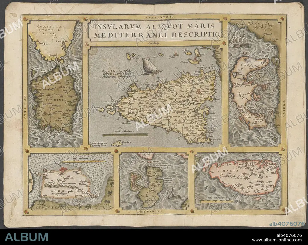
Mediterranean islands. The Mercator atlas of Europe. 1570-1572. Maps of Corsica, Sardinia, Sicily, Corfu, Elba and Malta. Image taken from The Mercator atlas of Europe. Originally published/produced in 1570-1572. . Source: Maps.C.29.c.13, 21.
| Partager |
|---|
 Pinterest Pinterest |
 Twitter Twitter |
 Facebook Facebook |
 Copier le lien Copier le lien |
 Email Email |
|
Ajouter à une autre Lightbox |
|
Ajouter à une autre Lightbox |


Avez-vous déjà un compte? S'identifier
Vous n'avez pas de compte ? S'inscrire
Acheter cette image

Légende:
Voir la traduction automatique
Mediterranean islands. The Mercator atlas of Europe. 1570-1572. Maps of Corsica, Sardinia, Sicily, Corfu, Elba and Malta. Image taken from The Mercator atlas of Europe. Originally published/produced in 1570-1572. . Source: Maps.C.29.c.13, 21.
Crédit:
Album / British Library
Autorisations:
Modèle: Non - Propriété: Non
Questions sur les droits?
Questions sur les droits?
Taille de l'image:
9589 x 7128 px | 195.6 MB
Taille d'impression:
81.2 x 60.4 cm | 32.0 x 23.8 in (300 dpi)
Mots clés:
