alb4054207
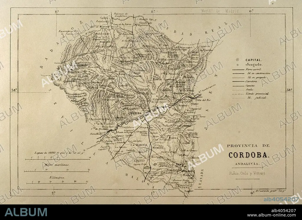
Map of the Cordoba province. Andalusia. Spain. Cronica General de Espa–a, Historia Ilustrada y Descriptiva de sus Provincias. Andalucia, 1867.
| Partager |
|---|
 Pinterest Pinterest |
 Twitter Twitter |
 Facebook Facebook |
 Copier le lien Copier le lien |
 Email Email |
|
Ajouter à une autre Lightbox |
|
Ajouter à une autre Lightbox |


Avez-vous déjà un compte? S'identifier
Vous n'avez pas de compte ? S'inscrire
Acheter cette image

Légende:
Voir la traduction automatique
Map of the Cordoba province. Andalusia. Spain. Cronica General de Espa–a, Historia Ilustrada y Descriptiva de sus Provincias. Andalucia, 1867.
Crédit:
Album / Prisma
Autorisations:
Modèle: Non - Propriété: Non
Questions sur les droits?
Questions sur les droits?
Taille de l'image:
4843 x 3292 px | 45.6 MB
Taille d'impression:
41.0 x 27.9 cm | 16.1 x 11.0 in (300 dpi)
Mots clés:
ANDALOUSE • ANDALOUSIE • CARTE (GEOGRAPHIE) • CARTE GEOGRAPHIQUE • CARTE • CARTOGRAPHIE • CORDOUE • DESSIN PLANS • ESPAGNE • EUROPE • EUROPÉEN • GEOGRAPHIE • HISOIRE • HISTOIRE • LEGENDE • LÉGENDES • MYTHES • PLAN (CARTOGRAPHIE) • PLANS • PROVINCE • PROVINS • SCIENCE: CARTOGRAPHIE • TERRITOIRE • XIXE SIÈCLE
