alb1649833
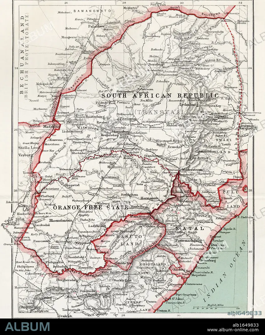
Map of South African republic, Orange Free State and Natal circa. 1900. From the book South Africa and the Transvaal War by Louis Creswicke, published 1900.
| Partager |
|---|
 Pinterest Pinterest |
 Twitter Twitter |
 Facebook Facebook |
 Copier le lien Copier le lien |
 Email Email |
|
Ajouter à une autre Lightbox |
|
Ajouter à une autre Lightbox |


Avez-vous déjà un compte? S'identifier
Vous n'avez pas de compte ? S'inscrire
Acheter cette image

Légende:
Voir la traduction automatique
Map of South African republic, Orange Free State and Natal circa. 1900. From the book South Africa and the Transvaal War by Louis Creswicke, published 1900.
Crédit:
Album / Universal History Archive/Universal Images Group
Autorisations:
Modèle: Non - Propriété: Non
Questions sur les droits?
Questions sur les droits?
Taille de l'image:
4016 x 4826 px | 55.5 MB
Taille d'impression:
34.0 x 40.9 cm | 13.4 x 16.1 in (300 dpi)
Mots clés:
AFRICAIN • AFRICAINE • AFRIQUE • CARTE (GEOGRAPHIE) • CARTE GEOGRAPHIQUE • CARTE • DESSIN PLANS • GUERRE • KEN • NATAL • ORANGE • PLAN (CARTOGRAPHIE) • PLANS • RÉPUBLIQUE • SUD
