alb3816549
Europe Map, After Fall of Constantinople, 1453
| Partager |
|---|
 Pinterest Pinterest |
 Twitter Twitter |
 Facebook Facebook |
 Copier le lien Copier le lien |
 Email Email |
|
Ajouter à une autre Lightbox |
|
Ajouter à une autre Lightbox |


Avez-vous déjà un compte? S'identifier
Vous n'avez pas de compte ? S'inscrire
Acheter cette image

Titre:
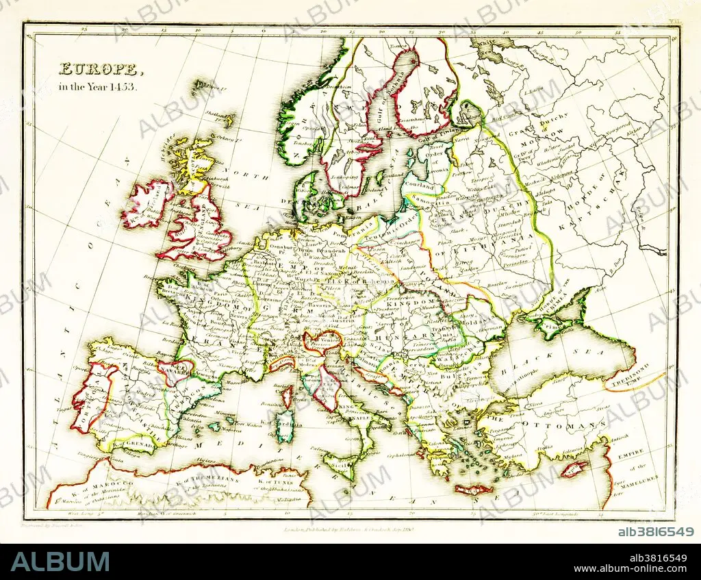
Europe Map, After Fall of Constantinople, 1453
Légende:
Voir la traduction automatique
A map of Europe, showing territorial borders existing in the 15th century, specifically 1453. The Fall of Constantinople, capital of the Byzantine Empire, to the invading army of the Ottoman Empire occurred on 29 May, 1453. Map published in 1831.
Crédit:
Album / Science Source / British Library
Autorisations:
Modèle: Non - Propriété: Non
Questions sur les droits?
Questions sur les droits?
Taille de l'image:
3543 x 2746 px | 27.8 MB
Taille d'impression:
30.0 x 23.2 cm | 11.8 x 9.2 in (300 dpi)
Mots clés:
