alb6092268
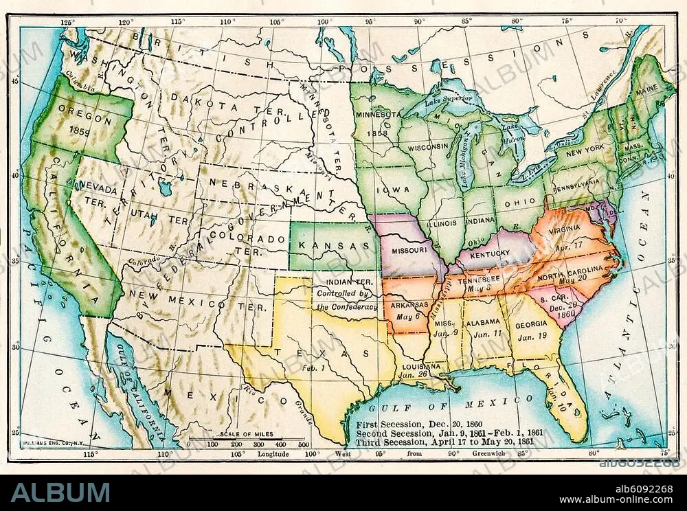
US map showing seceding states by date,
| Partager |
|---|
 Pinterest Pinterest |
 Twitter Twitter |
 Facebook Facebook |
 Copier le lien Copier le lien |
 Email Email |
|
Ajouter à une autre Lightbox |
|
Ajouter à une autre Lightbox |


Avez-vous déjà un compte? S'identifier
Vous n'avez pas de compte ? S'inscrire
Acheter cette image

Titre:
US map showing seceding states by date,
Légende:
Voir la traduction automatique
US map showing seceding states by date, American Civil War, 1860 and 1861. Printed color lithograph 19th century
Crédit:
Album / akg/North Wind Picture Archives
Autorisations:
Modèle: Non - Propriété: Non
Questions sur les droits?
Questions sur les droits?
Taille de l'image:
3364 x 2326 px | 22.4 MB
Taille d'impression:
28.5 x 19.7 cm | 11.2 x 7.8 in (300 dpi)
Mots clés:
AMERIQUE DU NORD • ART (CATÉGORIE) • ART • CARTE (GEOGRAPHIE) • CARTE GEOGRAPHIQUE • CARTE • DESSIN PLANS • ETATS-UNIS D'AMERIQUE (USA) • ETATS-UNIS D'AMERIQUE • GUERRE CIVILE • GUERRE • HISOIRE • HISTOIRE • ILLUSTRATION • PHOTOGRAPHIE • PLAN (CARTOGRAPHIE) • PLANS • SUD • UNITED STATES OF AMERICA • USA • XIXE SIÈCLE
