alb3837269
Upsala Glacier, Argentina, Satellite View
| Partager |
|---|
 Pinterest Pinterest |
 Twitter Twitter |
 Facebook Facebook |
 Copier le lien Copier le lien |
 Email Email |
|
Ajouter à une autre Lightbox |
|
Ajouter à une autre Lightbox |


Avez-vous déjà un compte? S'identifier
Vous n'avez pas de compte ? S'inscrire
Acheter cette image

Titre:
Upsala Glacier, Argentina, Satellite View
Légende:
Voir la traduction automatique
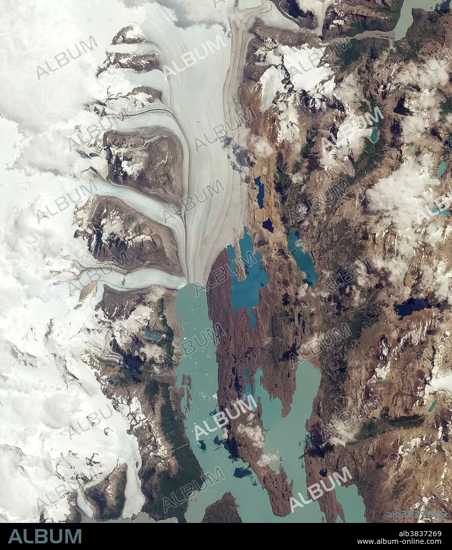
The Upsala Glacier in Argentina's Los Glaciares National Park is pictured in this Sentinel-2A satellite image. The park was named a UNESCO World Heritage site in 1981 and is the largest in the country, covering an area of over 7000 sq km. Many glaciers in the national park and in the wider Patagonian Ice Field have been retreating during the last 50 years because of rising temperatures. Upsala Glacier has retreated more than 3 km in the past 15 years. Glaciers are the largest reservoirs of freshwater on our planet, and their melting or growing is one of the best indicators of climate change. Satellite data can help to monitor changes in glacier mass and, subsequently, their contribution to rising sea levels. In the image, icebergs have broken off and are floating in the water of the upper reaches of Lake Argentino. Darker lines following the flow of the glacier are moraines: accumulations of rock, soil and other debris that have been deposited by the glacier.
Crédit:
Album / ESA/Science Source
Autorisations:
Modèle: Non - Propriété: Non
Questions sur les droits?
Questions sur les droits?
Taille de l'image:
2074 x 2400 px | 14.2 MB
Taille d'impression:
17.6 x 20.3 cm | 6.9 x 8.0 in (300 dpi)
Mots clés:
