alb3794201
Topographical Map of Coordinates 45 N, 90 E
| Partager |
|---|
 Pinterest Pinterest |
 Twitter Twitter |
 Facebook Facebook |
 Copier le lien Copier le lien |
 Email Email |
|
Ajouter à une autre Lightbox |
|
Ajouter à une autre Lightbox |


Avez-vous déjà un compte? S'identifier
Vous n'avez pas de compte ? S'inscrire
Acheter cette image.
Sélectionnez l'usage:

Titre: Topographical Map of Coordinates 45 N, 90 E
Légende: Voir la traduction automatique
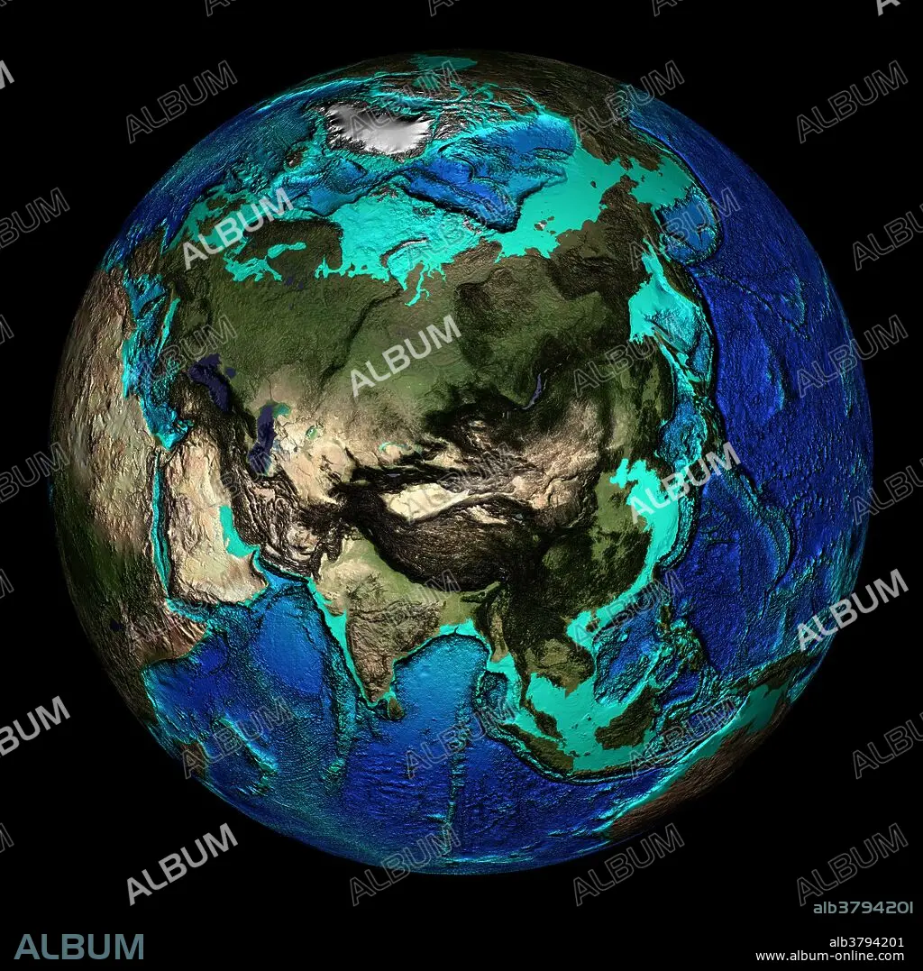
Topographical map of the Earth, centered on 45 degrees North, 90 degrees East. Specifically seen at these coordinates are the Himalaya mountain range (at center), which contains Mount Everest, the highest point on Earth (8848 meters above sea level). The lowest point in the Mariana Trench (10,900 meters below sea level) is also shown (lower edge of the dark arc at center right). The seas and oceans are color-coded by depth and land colors are based on MODIS true-color data from the Terra satellite in 2004 where darker regions represent highlands. Turquoise regions represent the continental shelf and descend to around 150 meters before dropping off abruptly at the shelf break. The descent of the continental slope to the ocean floor is shown as increasingly dark shades of blue.
Topographical map of the Earth, centered on 45 degrees North, 90 degrees East. Specifically seen at these coordinates are the Himalaya mountain range (at center), which contains Mount Everest, the highest point on Earth (8848 meters above sea level). The lowest point in the Mariana Trench (10,900 meters below sea level) is also shown (lower edge of the dark arc at center right). The seas and oceans are color-coded by depth and land colors are based on MODIS true-color data from the Terra satellite in 2004 where darker regions represent highlands. Turquoise regions represent the continental shelf and descend to around 150 meters before dropping off abruptly at the shelf break. The descent of the continental slope to the ocean floor is shown as increasingly dark shades of blue.
Crédit: Album / NOAA/Science Source
Autorisations: ? Autorisation de modèle: Non - ? Autorisation de propriété: Non
Questions sur les droits?
Questions sur les droits?
Taille de l'image: 2400 × 2400 px | 16.5 MB
Taille d'impression: 20.3 × 20.3 cm | 944.9 × 944.9 in (300 dpi)
Mots clés: ASIE • ASIE, CONTINENT • ASTRONOMIE: PLANETES • CARTE • CARTOGRAPHIE • CHAINE DE MONTAGNES • CONTINENT ASIE • CORDILLÈRE • GEOGRAPHIE • GLOBE • HIMALAYA • MASSIF • MER • OCEAN • OCEANOGRAPHIE • PAYSAGE MARITIME • PLANETE • PLANÈTES • SCIENCE: CARTOGRAPHIE • TERRA • TOPOGRAPHIE
