alb3907889
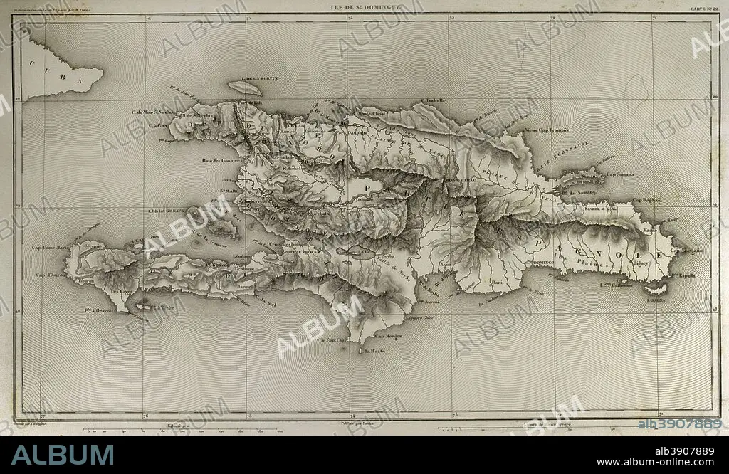
Napoleonic map. Island of Santo Domingo. Napoleon re-established slavery on the island, sending thousands of soldiers in 1802. Half of the French troops died because of yellow fever. Atlas de l'Histoire du Consulat et de l'Empire. History of the Consulate and the Empire of France under Napoleon by Marie Joseph Louis Adolphe Thiers (1797-1877). Drawings by Dufour and engravings by Dyonnet. Edited in Paris, 1864.
| Partager |
|---|
 Pinterest Pinterest |
 Twitter Twitter |
 Facebook Facebook |
 Copier le lien Copier le lien |
 Email Email |
|
Ajouter à une autre Lightbox |
|
Ajouter à une autre Lightbox |


Avez-vous déjà un compte? S'identifier
Vous n'avez pas de compte ? S'inscrire
Acheter cette image

Légende:
Voir la traduction automatique
Napoleonic map. Island of Santo Domingo. Napoleon re-established slavery on the island, sending thousands of soldiers in 1802. Half of the French troops died because of yellow fever. Atlas de l'Histoire du Consulat et de l'Empire. History of the Consulate and the Empire of France under Napoleon by Marie Joseph Louis Adolphe Thiers (1797-1877). Drawings by Dufour and engravings by Dyonnet. Edited in Paris, 1864.
Personnalités:
Crédit:
Album / Prisma
Autorisations:
Modèle: Non - Propriété: Non
Questions sur les droits?
Questions sur les droits?
Taille de l'image:
5079 x 3039 px | 44.2 MB
Taille d'impression:
43.0 x 25.7 cm | 16.9 x 10.1 in (300 dpi)
Mots clés:
AMERIQUE • AMERIQUE, CONTINENT • ANCIEN • ANTIQUE • ARCHIPEL • ARMEE: SOLDATS • AUTEUR • AUTEURS • CARAIBE • CARAIBES • CARTE (GEOGRAPHIE) • CARTE GEOGRAPHIQUE • CARTE • CARTOGRAPHIE • COLONIALISME • CONTINENT AMERIQUE • DESSIN PLANS • DESSIN • DESSINER • ESCLAVAGE • EUROPE • EUROPÉEN • FANCE • FIEVRE JAUNE • FRANÁAIS • FRANÁAISE • FRANCE • FRANÇAIS • FRANÇAISE • FRAVURE • GEOGRAPHIE • GRAVURE • HISOIRE • HISTOIRE • HISTORIQUE • ILE • ÎLES • MER DES CARAIBES • MER • MOTIF • NAPOLÉON IER • OCEAN • PAYSAGE MARITIME • PLAN (CARTOGRAPHIE) • PLANS • REPUBLIQUE DOMINICAINE • SCIENCE: CARTOGRAPHIE • SOLDAT DE L'ARMEE POPULAIRE NATIONALE • SOLDAT • TECHNIQUE: DESSIN • TERRITOIRE • THIERS • TROPICAL • XIXE SIÈCLE
