alb3809945
Atlas of al-Idrisi
| Partager |
|---|
 Pinterest Pinterest |
 Twitter Twitter |
 Facebook Facebook |
 Copier le lien Copier le lien |
 Email Email |
|
Ajouter à une autre Lightbox |
|
Ajouter à une autre Lightbox |


Avez-vous déjà un compte? S'identifier
Vous n'avez pas de compte ? S'inscrire
Acheter cette image

Titre:
Atlas of al-Idrisi
Légende:
Voir la traduction automatique
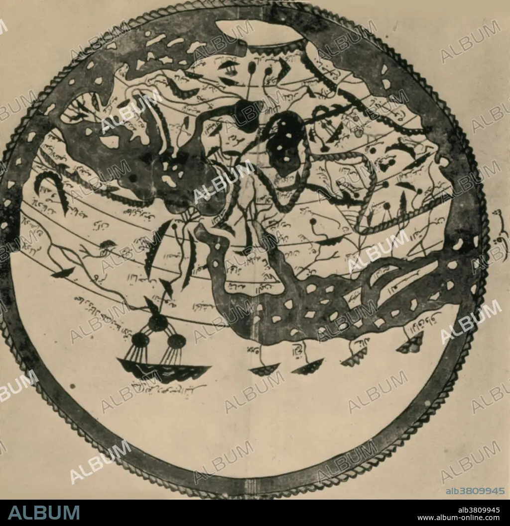
Arab geographers understood the outlines of Asia, Europe and North Africa by VI/12th century; their knowledge was summed up by the great atlas of al-Idrisi of 549/1154. It places south at the top; the map is inverted to make it easily recognizable.
Personnalités:
Crédit:
Album / Science Source / New York Public Library
Autorisations:
Modèle: Non - Propriété: Non
Questions sur les droits?
Questions sur les droits?
Taille de l'image:
3384 x 3321 px | 32.2 MB
Taille d'impression:
28.7 x 28.1 cm | 11.3 x 11.1 in (300 dpi)
Mots clés:
ARABE • ARABIE • CARTE • CARTES • CARTOGRAPHIE • CONTINENTAL • GEOGRAPHIE • ILLUSTRATION • ISLAMIQUE • SCIENCE: CARTOGRAPHIE
