alb4090842
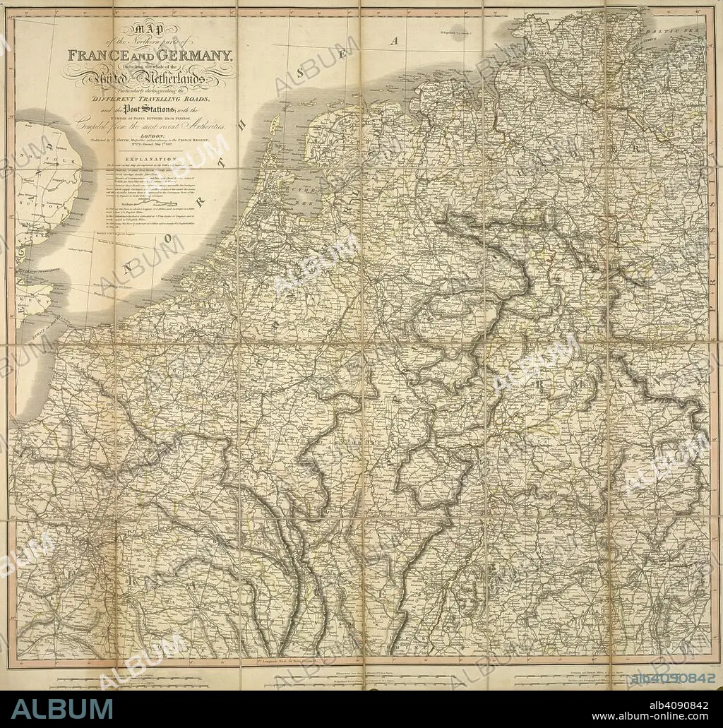
A map of the northern parts of France and Germany, including the whole of the United Netherlands. Map of the northern parts of France and Germany, including the whole of the United Netherlands, particularly distinguishing the different travelling roads...compiled from the most recent authorities. London : Published by C. Smith, Mapseller extraordinary to the Prince Regent, Nº. 172 Strand,, May 1st 1817. Source: Maps CC.5.a.207. Language: English.
| Partager |
|---|
 Pinterest Pinterest |
 Twitter Twitter |
 Facebook Facebook |
 Copier le lien Copier le lien |
 Email Email |
|
Ajouter à une autre Lightbox |
|
Ajouter à une autre Lightbox |


Avez-vous déjà un compte? S'identifier
Vous n'avez pas de compte ? S'inscrire
Acheter cette image

Légende:
Voir la traduction automatique
A map of the northern parts of France and Germany, including the whole of the United Netherlands. Map of the northern parts of France and Germany, including the whole of the United Netherlands, particularly distinguishing the different travelling roads...compiled from the most recent authorities. London : Published by C. Smith, Mapseller extraordinary to the Prince Regent, Nº. 172 Strand,, May 1st 1817. Source: Maps CC.5.a.207. Language: English.
Crédit:
Album / British Library
Autorisations:
Modèle: Non - Propriété: Non
Questions sur les droits?
Questions sur les droits?
Taille de l'image:
4890 x 4671 px | 65.3 MB
Taille d'impression:
41.4 x 39.5 cm | 16.3 x 15.6 in (300 dpi)
Mots clés:
