alb4080465
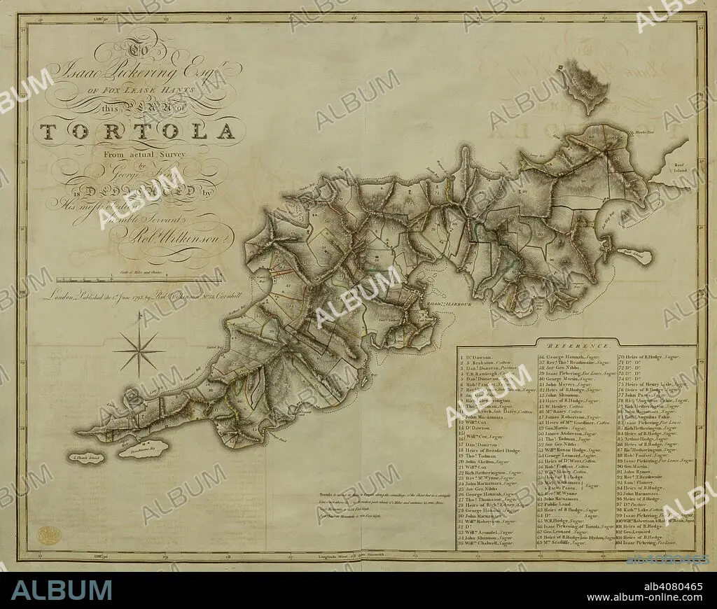
A plan of the Island of Tortola . A Plan of the Island of Tortola from actual Survey. Wilkinson, 1798. Source: Maps K.Top.123.72. Language: English.
| Partager |
|---|
 Pinterest Pinterest |
 Twitter Twitter |
 Facebook Facebook |
 Copier le lien Copier le lien |
 Email Email |
|
Ajouter à une autre Lightbox |
|
Ajouter à une autre Lightbox |


Avez-vous déjà un compte? S'identifier
Vous n'avez pas de compte ? S'inscrire
Acheter cette image

Légende:
Voir la traduction automatique
A plan of the Island of Tortola . A Plan of the Island of Tortola from actual Survey. Wilkinson, 1798. Source: Maps K.Top.123.72. Language: English.
Personnalités:
Crédit:
Album / British Library
Autorisations:
Modèle: Non - Propriété: Non
Questions sur les droits?
Questions sur les droits?
Taille de l'image:
7535 x 6012 px | 129.6 MB
Taille d'impression:
63.8 x 50.9 cm | 25.1 x 20.0 in (300 dpi)
Mots clés:
