alb9831058
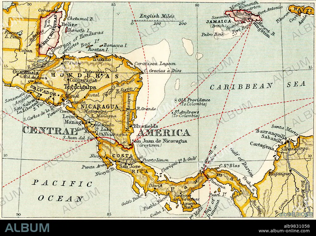
Map showing the Nicaraguan Canal, a proposed shipping route through Nicaragua via Lake Nicaragua in the first decade of the 20th century, which would have connected the Atlantic and the Pacific Oceans. The plan never went ahead after the building of the Panama canal. From The Business Encyclopaedia and Legal Adviser, published 1907.
| Partager |
|---|
 Pinterest Pinterest |
 Twitter Twitter |
 Facebook Facebook |
 Copier le lien Copier le lien |
 Email Email |
|
Ajouter à une autre Lightbox |
|
Ajouter à une autre Lightbox |


Avez-vous déjà un compte? S'identifier
Vous n'avez pas de compte ? S'inscrire
Acheter cette image

Légende:
Voir la traduction automatique
Map showing the Nicaraguan Canal, a proposed shipping route through Nicaragua via Lake Nicaragua in the first decade of the 20th century, which would have connected the Atlantic and the Pacific Oceans. The plan never went ahead after the building of the Panama canal. From The Business Encyclopaedia and Legal Adviser, published 1907.
Crédit:
Album / Ken Welsh/Universal History Archive/Universal Images Group
Autorisations:
Modèle: Non - Propriété: Non
Questions sur les droits?
Questions sur les droits?
Taille de l'image:
5232 x 3642 px | 54.5 MB
Taille d'impression:
44.3 x 30.8 cm | 17.4 x 12.1 in (300 dpi)
Mots clés:
