alb9432599
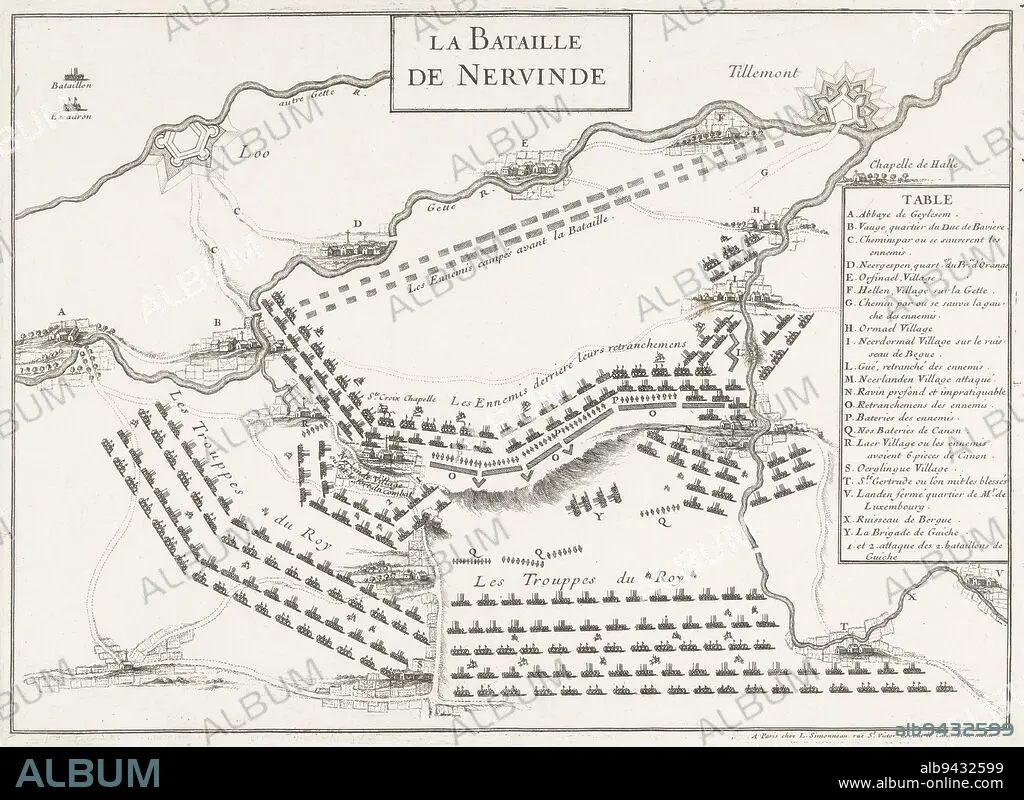
Map of the battle at Landen (Neerwinden) between the Allies under King William III and the French under the Duke of Luxembourg, 29 July 1693. On the right the legend A-Y in French. Map of the battle of Landen, 1693 La Bataille de Neervinde , print maker: anonymous, publisher: Louis Simonneau, (mentioned on object), print maker: France, publisher: Paris, 1693, paper, etching, h 241 mm × w 333 mm.
| Partager |
|---|
 Pinterest Pinterest |
 Twitter Twitter |
 Facebook Facebook |
 Copier le lien Copier le lien |
 Email Email |
|
Ajouter à une autre Lightbox |
|
Ajouter à une autre Lightbox |


Avez-vous déjà un compte? S'identifier
Vous n'avez pas de compte ? S'inscrire
Acheter cette image

Légende:
Voir la traduction automatique
Map of the battle at Landen (Neerwinden) between the Allies under King William III and the French under the Duke of Luxembourg, 29 July 1693. On the right the legend A-Y in French. Map of the battle of Landen, 1693 La Bataille de Neervinde , print maker: anonymous, publisher: Louis Simonneau, (mentioned on object), print maker: France, publisher: Paris, 1693, paper, etching, h 241 mm × w 333 mm
Crédit:
Album / quintlox
Autorisations:
Modèle: Non - Propriété: Non
Questions sur les droits?
Questions sur les droits?
Taille de l'image:
4951 x 3612 px | 51.2 MB
Taille d'impression:
41.9 x 30.6 cm | 16.5 x 12.0 in (300 dpi)
Mots clés:
BATAILLE • BATALLE • CARTE (GEOGRAPHIE) • CARTE GEOGRAPHIQUE • CARTE • DESSIN PLANS • DUC • FRANÁAIS • FRANÁAISE • FRANCE • FRANÇAIS • LUXEMBOURG • OBJET • PAPIER • PARIS • PARIS, FRANCE • PLAN (CARTOGRAPHIE) • PLANS
