alb3548564
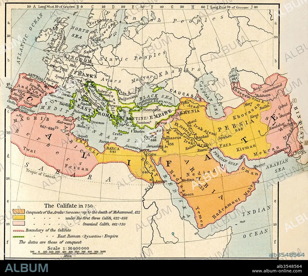
Map of the Muslim expansion and the Byzantine Empire at the end of the Umayyad Caliphate, in 750
| Partager |
|---|
 Pinterest Pinterest |
 Twitter Twitter |
 Facebook Facebook |
 Copier le lien Copier le lien |
 Email Email |
|
Ajouter à une autre Lightbox |
|
Ajouter à une autre Lightbox |


Avez-vous déjà un compte? S'identifier
Vous n'avez pas de compte ? S'inscrire
Acheter cette image

Titre:
Map of the Muslim expansion and the Byzantine Empire at the end of the Umayyad Caliphate, in 750
Légende:
Voir la traduction automatique
Map of the Muslim expansion and the Byzantine Empire at the end of the Umayyad Caliphate, in 750. From Historical Atlas, published 1923.
Crédit:
Album / Universal Images Group / Universal History Archive
Autorisations:
Modèle: Non - Propriété: Non
Questions sur les droits?
Questions sur les droits?
Taille de l'image:
4724 x 3982 px | 53.8 MB
Taille d'impression:
40.0 x 33.7 cm | 15.7 x 13.3 in (300 dpi)
Mots clés:
8E SIECLE • 8EME S • BYZANTIN • BYZANTINE • CARTE (GEOGRAPHIE) • CARTE GEOGRAPHIQUE • CARTE • DESSIN PLANS • GEOGRAPHIE • HISOIRE • HISTOIRE • MUSULMAN • MUSUSLMAN • PAYS • PLAN (CARTOGRAPHIE) • PLANS
