alb9060589
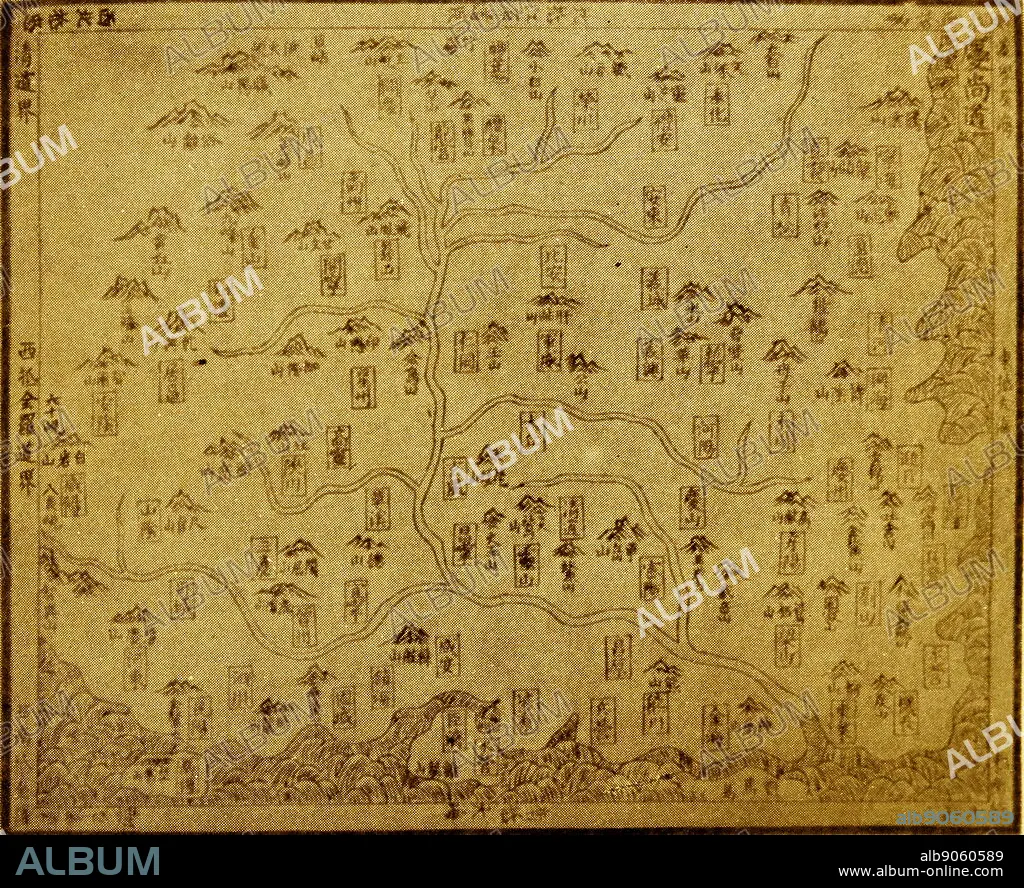
A Korean map from 16th Century Joseon dynasty.
| Partager |
|---|
 Pinterest Pinterest |
 Twitter Twitter |
 Facebook Facebook |
 Copier le lien Copier le lien |
 Email Email |
|
Ajouter à une autre Lightbox |
|
Ajouter à une autre Lightbox |


Avez-vous déjà un compte? S'identifier
Vous n'avez pas de compte ? S'inscrire
Acheter cette image

Titre:
A Korean map from 16th Century Joseon dynasty.
Légende:
Voir la traduction automatique
A 16th century map of Kyeong-sang-do province from the book Shin-jeung-Dong-guk-yeo-ji-seung-ram ("New Revised Edition of Dong-guk-Yeo-Ji-Seung-Ram")which is a Korean geography book that was published by the Joseon dynasty in 1530. The original wooden print is currently in Kyu-jang-gak, the royal library of the Joseon Dynasty, founded in 1776 by order of King Jeong-jo of Joseon.
Crédit:
Album / World History Archive
Autorisations:
Modèle: Non - Propriété: Non
Questions sur les droits?
Questions sur les droits?
Taille de l'image:
5072 x 4135 px | 60.0 MB
Taille d'impression:
42.9 x 35.0 cm | 16.9 x 13.8 in (300 dpi)
Mots clés:
