alb4314029
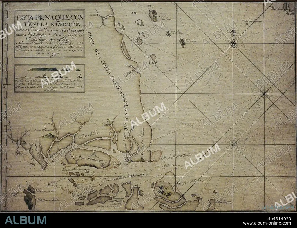
Chart of the Singapore Strait, 1778. It is a representation of Singapore with the name of "Island and Kingdom of Sincapura", as an independent realm prior to British colonisation. It includes an elevation plan of Viola Island, identified as "Island of Vandurria", the earliest known depiction of this land in a Spanish document. Naval Museum. Madrid. Spain.
| Partager |
|---|
 Pinterest Pinterest |
 Twitter Twitter |
 Facebook Facebook |
 Copier le lien Copier le lien |
 Email Email |
|
Ajouter à une autre Lightbox |
|
Ajouter à une autre Lightbox |


Avez-vous déjà un compte? S'identifier
Vous n'avez pas de compte ? S'inscrire
Acheter cette image

Légende:
Voir la traduction automatique
Chart of the Singapore Strait, 1778. It is a representation of Singapore with the name of "Island and Kingdom of Sincapura", as an independent realm prior to British colonisation. It includes an elevation plan of Viola Island, identified as "Island of Vandurria", the earliest known depiction of this land in a Spanish document. Naval Museum. Madrid. Spain.
Crédit:
Album / Prisma
Autorisations:
Modèle: Non - Propriété: Non
Questions sur les droits?
Questions sur les droits?
Taille de l'image:
4016 x 2874 px | 33.0 MB
Taille d'impression:
34.0 x 24.3 cm | 13.4 x 9.6 in (300 dpi)
Mots clés:
18 18E 18EME XVIII XVIIIE XVIIIEME SIECLE • 18E SIECLE • 18EME S • ARCHIPEL • ASIE • ASIE, CONTINENT • CARTE (GEOGRAPHIE) • CARTE GEOGRAPHIQUE • CARTE • CARTOGRAPHIE • CONTINENT ASIE • CÔTE • DESSIN PLANS • DETROIT • DIX-HUITIÈME SIÈCLE • ÉTROIT • GEOGRAPHIE • HISOIRE • HISTOIRE • ILE • ÎLES • LITTORAL • MARITIME • MER • MUSÉE • NAVIGATION MARITIME ET FLUVIALE • NAVIGATION • OCEAN • PAYSAGE MARITIME • PLAN (CARTOGRAPHIE) • PLANS • ROSE DES VENTS • SCIENCE: CARTOGRAPHIE • XVIIIE SIECLE
