alb3929000
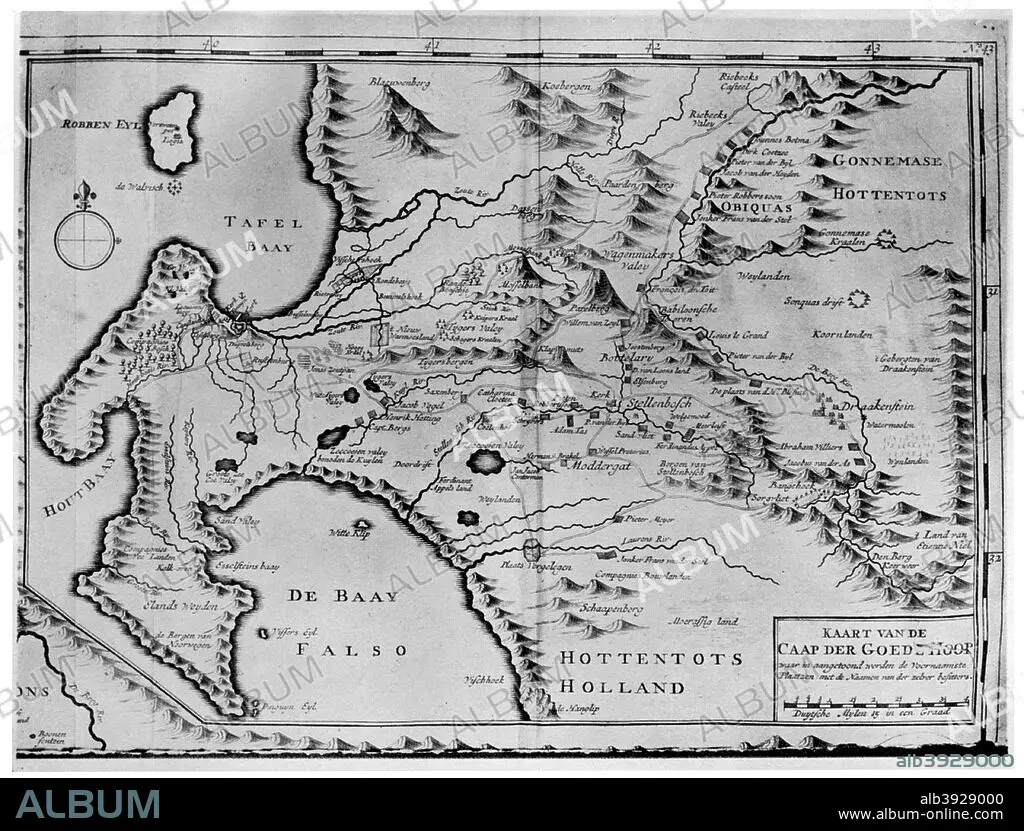
A map of the Cape of Good Hope in the time of the van der Stels, South Africa, 18th century (1931). Artist: Unknown
| Partager |
|---|
 Pinterest Pinterest |
 Twitter Twitter |
 Facebook Facebook |
 Copier le lien Copier le lien |
 Email Email |
|
Ajouter à une autre Lightbox |
|
Ajouter à une autre Lightbox |


Avez-vous déjà un compte? S'identifier
Vous n'avez pas de compte ? S'inscrire
Acheter cette image

Titre:
A map of the Cape of Good Hope in the time of the van der Stels, South Africa, 18th century (1931). Artist: Unknown
Légende:
Voir la traduction automatique
A map of the Cape of Good Hope in the time of the van der Stels, South Africa, 18th century (1931).
Crédit:
Album / The Print Collector / Heritage Images
Autorisations:
Modèle: Non - Propriété: Non
Questions sur les droits?
Questions sur les droits?
Taille de l'image:
4799 x 3645 px | 50.0 MB
Taille d'impression:
40.6 x 30.9 cm | 16.0 x 12.2 in (300 dpi)
Mots clés:
