alb3547855
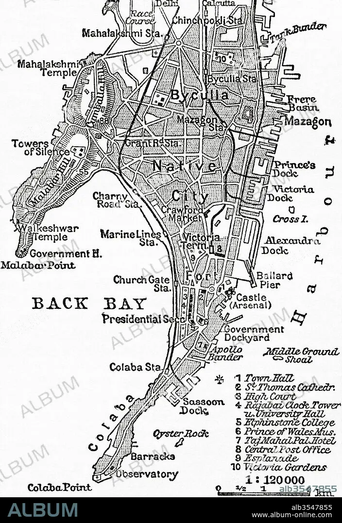
Map of Bombay, India, circa 1920
| Partager |
|---|
 Pinterest Pinterest |
 Twitter Twitter |
 Facebook Facebook |
 Copier le lien Copier le lien |
 Email Email |
|
Ajouter à une autre Lightbox |
|
Ajouter à une autre Lightbox |


Avez-vous déjà un compte? S'identifier
Vous n'avez pas de compte ? S'inscrire
Acheter cette image

Titre:
Map of Bombay, India, circa 1920
Légende:
Voir la traduction automatique
Map of Bombay, India, c. 1920. From Meyers Lexicon, published 1924.
Crédit:
Album / Universal Images Group / Universal History Archive
Autorisations:
Modèle: Non - Propriété: Non
Questions sur les droits?
Questions sur les droits?
Taille de l'image:
3624 x 5274 px | 54.7 MB
Taille d'impression:
30.7 x 44.7 cm | 12.1 x 17.6 in (300 dpi)
Mots clés:
BOMBAY • CAPITALE • CARTE (GEOGRAPHIE) • CARTE GEOGRAPHIQUE • CARTE • CITE • DESSIN PLANS • GEOGRAPHIE • HISOIRE • HISTOIRE • ILLUSTRATION • INDE • INDES • INDIEN • INDIENNE • INDIENS • METROPOLE • MUMBAI • PLAN (CARTOGRAPHIE) • PLANS • VILE • VILLE • XXE SIECLE
