alb3822803
Map of Europe, 1700
| Partager |
|---|
 Pinterest Pinterest |
 Twitter Twitter |
 Facebook Facebook |
 Copier le lien Copier le lien |
 Email Email |
|
Ajouter à une autre Lightbox |
|
Ajouter à une autre Lightbox |


Avez-vous déjà un compte? S'identifier
Vous n'avez pas de compte ? S'inscrire
Acheter cette image

Titre:
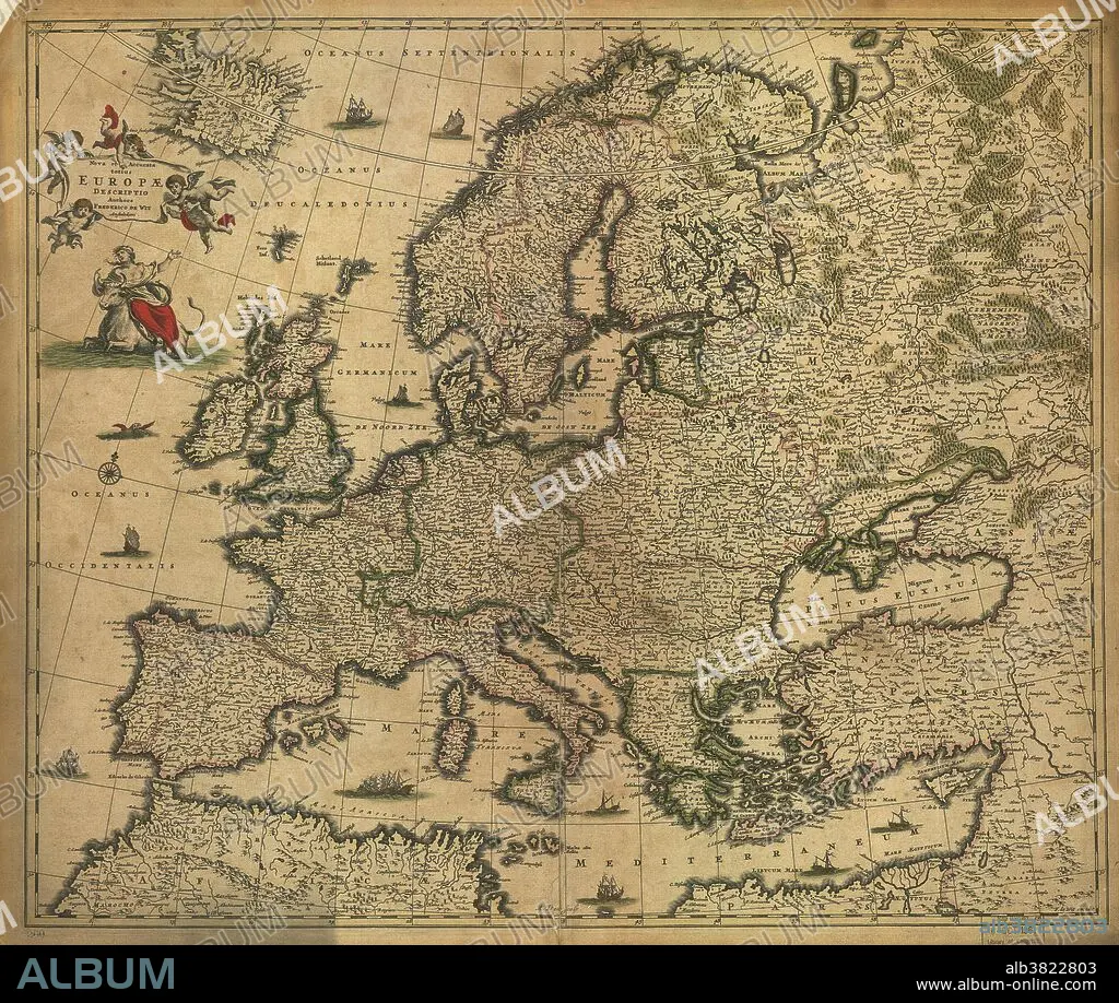
Map of Europe, 1700
Légende:
Voir la traduction automatique
17th century map of Europe. Published in 1700, this map by the Dutch cartographer Frederick de Witt (1630-1706) shows the latest knowledge of the geography of Europe. The mapping has improved greatly on earlier maps, though there are still errors and distortions of scale. The inscriptions are in Latin. The title banner at upper left is being carried by cherubs, and below that is a depiction of the mythological tale of Europa, carried away by Zeus who took the form of a white bull. The continent of Europe is named after Europa.
Crédit:
Album / Science Source / LOC/Geography and Map Division
Autorisations:
Modèle: Non - Propriété: Non
Questions sur les droits?
Questions sur les droits?
Taille de l'image:
7024 x 5936 px | 119.3 MB
Taille d'impression:
59.5 x 50.3 cm | 23.4 x 19.8 in (300 dpi)
Mots clés:
