alb6147933
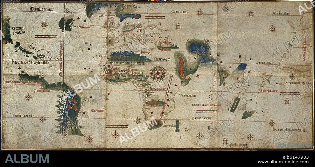
ALBERTO CANTINO. PLANISFERIO DE 1502 - LA COSTA DE AMERICA APARECE POR PRIMERA VEZ - LINEA DE DEMARCACION DEL TRATADO DE TORDESILLAS (IZQUIERDA)
| Partager |
|---|
 Pinterest Pinterest |
 Twitter Twitter |
 Facebook Facebook |
 Copier le lien Copier le lien |
 Email Email |
|
Ajouter à une autre Lightbox |
|
Ajouter à une autre Lightbox |


Avez-vous déjà un compte? S'identifier
Vous n'avez pas de compte ? S'inscrire
Acheter cette image

Auteur:
Titre:
PLANISFERIO DE 1502 - LA COSTA DE AMERICA APARECE POR PRIMERA VEZ - LINEA DE DEMARCACION DEL TRATADO DE TORDESILLAS (IZQUIERDA)
Légende:
Voir la traduction automatique
The Cantino planisphere. It's the ealiest map where one can see for the very first time the American coasts.. Modena, Estense library. Italy
Emplacement:
Crédit:
Album / Oronoz
Autorisations:
Modèle: Non - Propriété: Non
Questions sur les droits?
Questions sur les droits?
Taille de l'image:
6349 x 3038 px | 55.2 MB
Taille d'impression:
53.8 x 25.7 cm | 21.2 x 10.1 in (300 dpi)
Mots clés:
16E SIECLE • 16EME S • AFRIQUE • AMERIQUE • AMERIQUE, CONTINENT • BIBLIOTECA ESTENSE • CANTINO, ALBERTO • CARTE (GEOGRAPHIE) • CARTE GEOGRAPHIQUE • CARTE • CARTOGRAPHIE • CONTINENT AMERIQUE • DESSIN PLANS • MAPPEMONDE • MODENE • PLAN (CARTOGRAPHIE) • PLANISPHERE • PLANS • SCIENCE: CARTOGRAPHIE • SEIZIÈME SIÈCLE • SUD AMERICAIN • XVIE SIECLE
