alb5478470
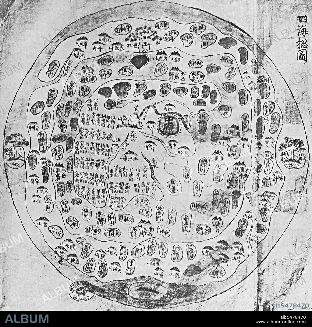
A traditional Chinese map of the world showing China as the 'Middle Kingdom' at the centre of the map. Korea,17th century.
| Partager |
|---|
 Pinterest Pinterest |
 Twitter Twitter |
 Facebook Facebook |
 Copier le lien Copier le lien |
 Email Email |
|
Ajouter à une autre Lightbox |
|
Ajouter à une autre Lightbox |


Avez-vous déjà un compte? S'identifier
Vous n'avez pas de compte ? S'inscrire
Acheter cette image

Titre:
A traditional Chinese map of the world showing China as the 'Middle Kingdom' at the centre of the map. Korea,17th century.
Légende:
Voir la traduction automatique
This Chonhado (map of all under heaven), was produced in Korea in the 17th century. The map comes out of the Buddhist tradition of China with data possibly 2000 years old, although the earliest-known surviving examples date from the sixteenth century. From that time, the style gained popularity in Korea, and by the end of the nineteenth century numerous copies existed. The structure of the map is simple. A main continent, containing China, Korea, and a number of historically known countries, occupies the center of the circular map, surrounded by an enclosing sea ring, which is itself surrounded by an outerring of land.
Crédit:
Album / Pictures From History/Universal Images Group
Autorisations:
Modèle: Non - Propriété: Non
Questions sur les droits?
Questions sur les droits?
Taille de l'image:
4195 x 4173 px | 50.1 MB
Taille d'impression:
35.5 x 35.3 cm | 14.0 x 13.9 in (300 dpi)
Mots clés:
17E SIECLE • 17EME S • ASIE • ASIE, CONTINENT • CARTE (GEOGRAPHIE) • CARTE GEOGRAPHIQUE • CARTE • CARTOGRAPHIE • CHINE • CHINOIS • CHINOISE • CONTINENT ASIE • COREE • DESSIN PLANS • DIX-SEPTIÈME SIÈCLE • HISOIRE • HISTOIRE • PLAN (CARTOGRAPHIE) • PLANS • SCIENCE: CARTOGRAPHIE • XVIIE SIECLE
