alb3982592
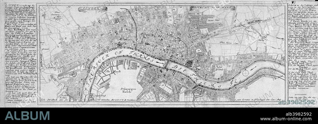
Map of London, 1700. Artist: Augustae Vindelicorum
| Partager |
|---|
 Pinterest Pinterest |
 Twitter Twitter |
 Facebook Facebook |
 Copier le lien Copier le lien |
 Email Email |
|
Ajouter à une autre Lightbox |
|
Ajouter à une autre Lightbox |


Avez-vous déjà un compte? S'identifier
Vous n'avez pas de compte ? S'inscrire
Acheter cette image

Titre:
Map of London, 1700. Artist: Augustae Vindelicorum
Légende:
Voir la traduction automatique
Map of London, 1700. The City of London, City of Westminster, River Thames, Lambeth, Southwark and surrounding areas; either side contains text in German.
Crédit:
Album / The London Archives (City of London)/Heritage Images
Autorisations:
Modèle: Non - Propriété: Non
Questions sur les droits?
Questions sur les droits?
Taille de l'image:
4306 x 1460 px | 18.0 MB
Taille d'impression:
36.5 x 12.4 cm | 14.4 x 4.9 in (300 dpi)
Mots clés:
