alb3547570
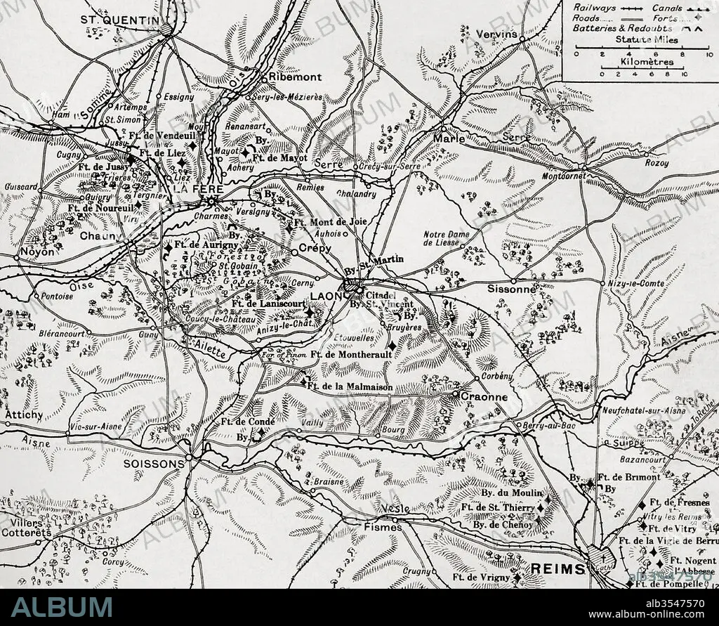
Map illustrating the region of the First Battle of the Aisne, fought along the Rivers Aisne, Oise and Somme, France during WWI
| Partager |
|---|
 Pinterest Pinterest |
 Twitter Twitter |
 Facebook Facebook |
 Copier le lien Copier le lien |
 Email Email |
|
Ajouter à une autre Lightbox |
|
Ajouter à une autre Lightbox |


Avez-vous déjà un compte? S'identifier
Vous n'avez pas de compte ? S'inscrire
Acheter cette image

Titre:
Map illustrating the region of the First Battle of the Aisne, fought along the Rivers Aisne, Oise and Somme, France during WWI
Légende:
Voir la traduction automatique
Map illustrating the region of the First Battle of the Aisne, fought along the Rivers Aisne, Oise and Somme, France during WWI. From The War Illustrated Album Deluxe, published 1915.
Crédit:
Album / Universal Images Group / Universal History Archive
Autorisations:
Modèle: Non - Propriété: Non
Questions sur les droits?
Questions sur les droits?
Taille de l'image:
4835 x 3957 px | 54.7 MB
Taille d'impression:
40.9 x 33.5 cm | 16.1 x 13.2 in (300 dpi)
Mots clés:
BATAILLE • BATALLE • CARTE (GEOGRAPHIE) • CARTE GEOGRAPHIQUE • CARTE • DESSIN PLANS • FLEUVE • FRANCE • GRANDE GUERRE • GUERRE 14-18 • GUERRE 1914-1918 • GUERRE MONDIALE I • GUERRE • MONDE • OCCIDENTAL • OCCIDENTAUX • PLAN (CARTOGRAPHIE) • PLANS • PREMIERE FOIS • PREMIERE GUERRE MONDIALE (1914-1918) • PREMIERE GUERRE MONDIALE • RIO • RIVIÈRE FLEUVE • RIVIERE • RIVIRE • RIVIRE • SOMME • TERROIR • WESTERN
