alb4496029
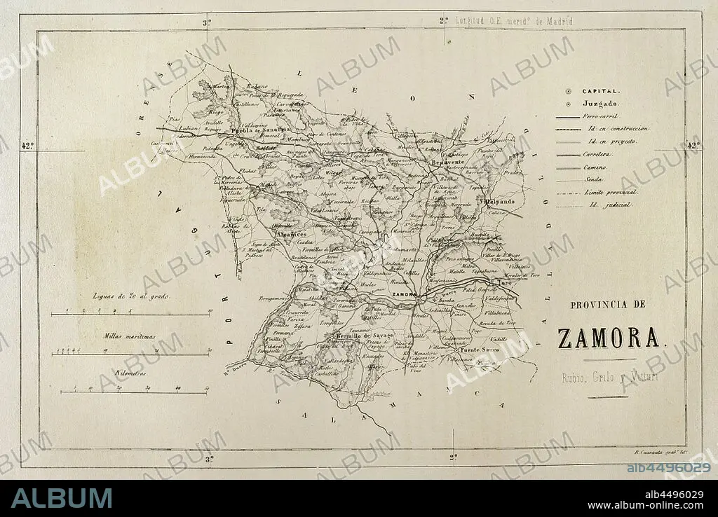
Spain. Map of the province of Zamora. Cronica General de Espa–a, Historia Ilustrada y Descriptiva de sus Provincias. Asturias and Leon, 1867.
| Partager |
|---|
 Pinterest Pinterest |
 Twitter Twitter |
 Facebook Facebook |
 Copier le lien Copier le lien |
 Email Email |
|
Ajouter à une autre Lightbox |
|
Ajouter à une autre Lightbox |


Avez-vous déjà un compte? S'identifier
Vous n'avez pas de compte ? S'inscrire
Acheter cette image

Légende:
Voir la traduction automatique
Spain. Map of the province of Zamora. Cronica General de Espa–a, Historia Ilustrada y Descriptiva de sus Provincias. Asturias and Leon, 1867.
Crédit:
Album / Prisma
Autorisations:
Modèle: Non - Propriété: Non
Questions sur les droits?
Questions sur les droits?
Taille de l'image:
4622 x 3093 px | 40.9 MB
Taille d'impression:
39.1 x 26.2 cm | 15.4 x 10.3 in (300 dpi)
Mots clés:
ANCIEN • ANTIQUE • CARTE (GEOGRAPHIE) • CARTE GEOGRAPHIQUE • CARTE • CARTOGRAPHIE • DESSIN PLANS • DESSIN • DESSINER • ESPAGNE • ESPAGNOL • EUROPE • EUROPÉEN • FRAVURE • GEOGRAPHIE • GRAVURE • HISOIRE • HISTOIRE • LEGENDE • LÉGENDES • MOTIF • MYTHES • PLAN (CARTOGRAPHIE) • PLANS • PROVINCE • PROVINS • SCIENCE: CARTOGRAPHIE • TECHNIQUE: DESSIN • TERRITOIRE • XIXE SIÈCLE • ZAMORA
