alb9658173
map, Acre, Israel, Third Crusade, Richard I, middle ages, 12th century, historical,
| Partager |
|---|
 Pinterest Pinterest |
 Twitter Twitter |
 Facebook Facebook |
 Copier le lien Copier le lien |
 Email Email |
|
Ajouter à une autre Lightbox |
|
Ajouter à une autre Lightbox |


Avez-vous déjà un compte? S'identifier
Vous n'avez pas de compte ? S'inscrire
Acheter cette image

Titre:
map, Acre, Israel, Third Crusade, Richard I, middle ages, 12th century, historical,
Légende:
Voir la traduction automatique
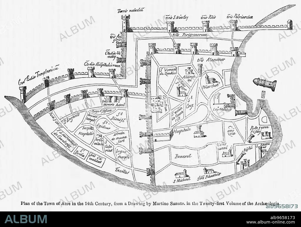
Plan of the Town of Acre in the 14th Century, from a Drawing by Martino Santo in the Twenty-Twenty-First Volume of the Archaeologia, Illustration from John Cassell's Illustrated History of England, Vol. I from the earliest period to the reign of Edward the Fourth, Cassell, Petter and Galpin, 1857
Crédit:
Album / Universal Images Group / JT Vintage / Glasshouse Images
Autorisations:
Modèle: Non - Propriété: Non
Questions sur les droits?
Questions sur les droits?
Taille de l'image:
5010 x 3522 px | 50.5 MB
Taille d'impression:
42.4 x 29.8 cm | 16.7 x 11.7 in (300 dpi)
Mots clés:
