alb5411696
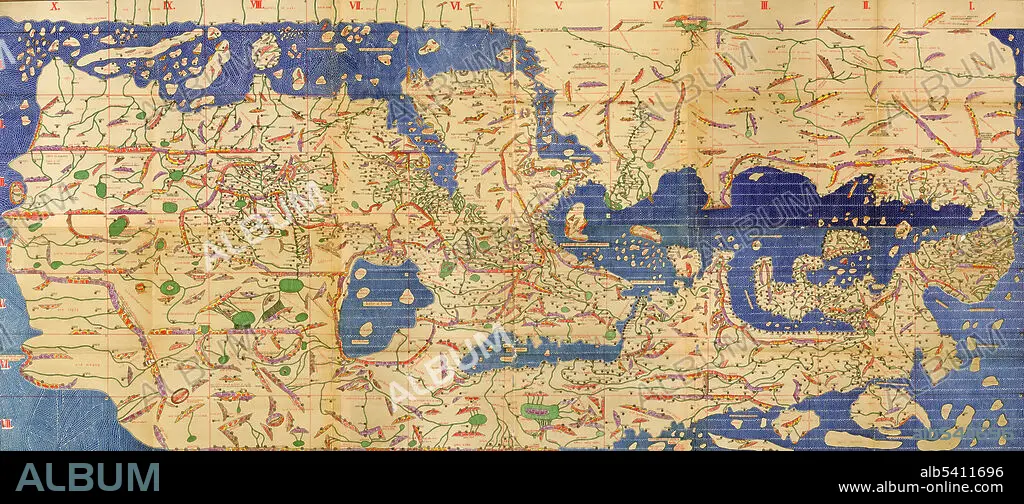
Tabula Rogeriana, Drawn by Al-Idrisi,1154
| Partager |
|---|
 Pinterest Pinterest |
 Twitter Twitter |
 Facebook Facebook |
 Copier le lien Copier le lien |
 Email Email |
|
Ajouter à une autre Lightbox |
|
Ajouter à une autre Lightbox |


Avez-vous déjà un compte? S'identifier
Vous n'avez pas de compte ? S'inscrire
Acheter cette image

Titre:
Tabula Rogeriana, Drawn by Al-Idrisi,1154
Légende:
Voir la traduction automatique
The Tabula Rogeriana, drawn by Al-Idrisi for Roger II of Sicily in 1154, was one of the most advanced world maps of its era, showing Europe, Asia, and part of Africa. Muhammad al-Idrisi was an Arab Muslim geographer, cartographer and Egyptologist who lived in Palermo, Sicily at the court of King Roger II.
Crédit:
Album / Science Source
Autorisations:
Modèle: Non - Propriété: Non
Questions sur les droits?
Questions sur les droits?
Taille de l'image:
8100 x 3567 px | 82.7 MB
Taille d'impression:
68.6 x 30.2 cm | 27.0 x 11.9 in (300 dpi)
Mots clés:
