alb3208032
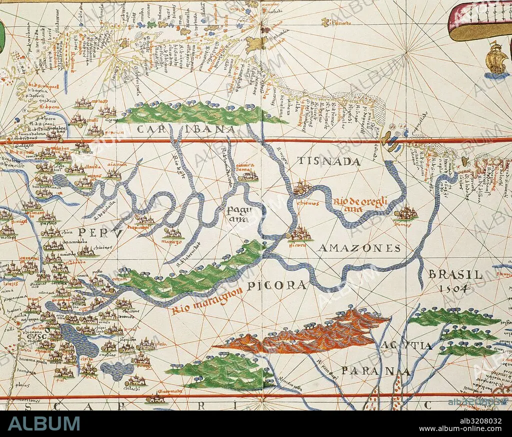
Portolan atlas of the world by Joan Martines (1556-1590). Messina, 1587. Amazon basin and two mouths. National Library. Madrid. Spain.
| Partager |
|---|
 Pinterest Pinterest |
 Twitter Twitter |
 Facebook Facebook |
 Copier le lien Copier le lien |
 Email Email |
|
Ajouter à une autre Lightbox |
|
Ajouter à une autre Lightbox |


Avez-vous déjà un compte? S'identifier
Vous n'avez pas de compte ? S'inscrire
Acheter cette image

Légende:
Voir la traduction automatique
Portolan atlas of the world by Joan Martines (1556-1590). Messina, 1587. Amazon basin and two mouths. National Library. Madrid. Spain.
Crédit:
Album / Prisma
Autorisations:
Modèle: Non - Propriété: Non
Questions sur les droits?
Questions sur les droits?
Taille de l'image:
4999 x 4015 px | 57.4 MB
Taille d'impression:
42.3 x 34.0 cm | 16.7 x 13.4 in (300 dpi)
Mots clés:
16E SIECLE • 16EME S • AMÉRIQUE DU SUD • AMERIQUE • AMERIQUE, CONTINENT • BOUCHE • BRÉSIL • CARTE (GEOGRAPHIE) • CARTE GEOGRAPHIQUE • CARTE MARINE • CARTE • CARTOGRAPHIE • CHERCHEUR • CONTINENT AMERIQUE • COSMOGRAPHE • DÉCOUVERTE • DECOUVREUR • DESSIN PLANS • ÉCLAIRÉ • ECRITURE MANUSCRITS (MSS) • EXPLORATEUR • FLUVIALE • GEOGRAPHIE • HISOIRE • HISTOIRE • ILLUMINÉ • MANUSCRITS • MEANDRE • NAVIGATION MARITIME ET FLUVIALE • NAVIGATION • PARANÀ • PLAN (CARTOGRAPHIE) • PLANS • SCIENCE: CARTOGRAPHIE • SEIZIÈME SIÈCLE • XVIE SIECLE
